You are here: Home > Network List > TA - USArray Transportable Network (new EarthScope stations) Stations List
> Station G59A Clarenceville, QC, USA > Earthquake Result Viewer
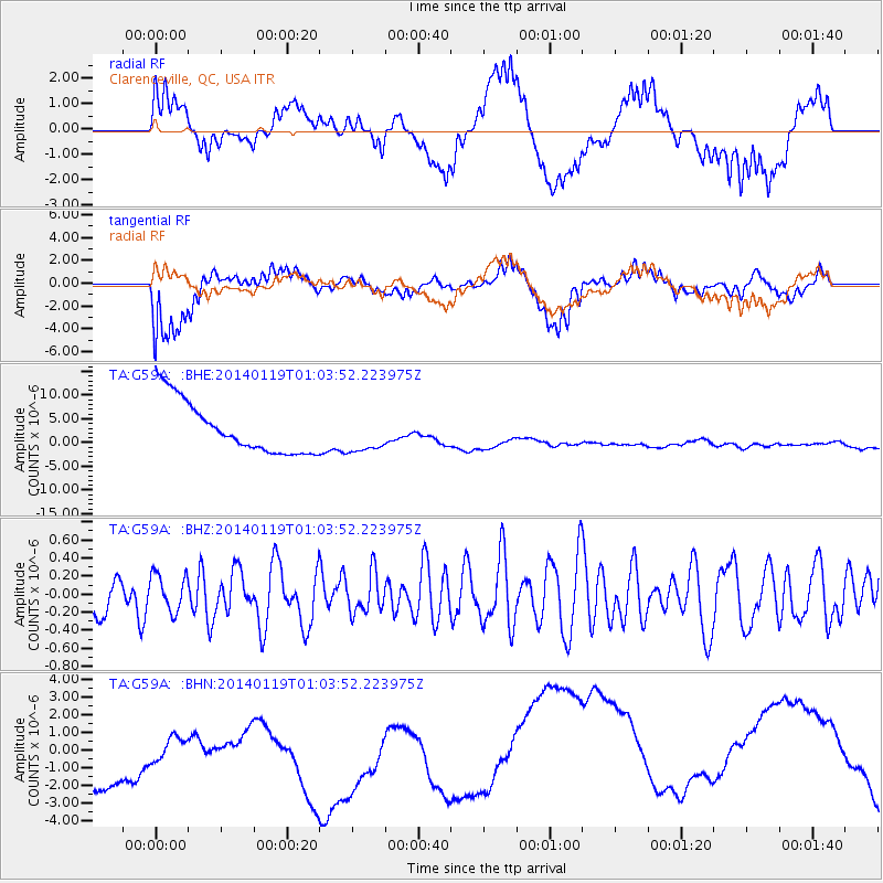
G59A Clarenceville, QC, USA - Earthquake Result Viewer
*The percent match for this event was below the threshold and hence no stack was calculated.
| Earthquake location: |
Kuril Islands |
| Earthquake latitude/longitude: |
49.1/156.4 |
| Earthquake time(UTC): |
2014/01/19 (019) 00:52:35 GMT |
| Earthquake Depth: |
34 km |
| Earthquake Magnitude: |
4.9 MW |
| Earthquake Catalog/Contributor: |
ISC/ISC |
|
| Network: |
TA USArray Transportable Network (new EarthScope stations) |
| Station: |
G59A Clarenceville, QC, USA |
| Lat/Lon: |
45.08 N/73.18 W |
| Elevation: |
36 m |
|
| Distance: |
76.7 deg |
| Az: |
33.625 deg |
| Baz: |
329.071 deg |
| Ray Param: |
$rayparam |
*The percent match for this event was below the threshold and hence was not used in the summary stack. |
|
| Radial Match: |
34.302017 % |
| Radial Bump: |
400 |
| Transverse Match: |
49.421745 % |
| Transverse Bump: |
400 |
| SOD ConfigId: |
3390531 |
| Insert Time: |
2019-04-10 01:13:36.914 +0000 |
| GWidth: |
2.5 |
| Max Bumps: |
400 |
| Tol: |
0.001 |
|
Signal To Noise
| Channel | StoN | STA | LTA |
| TA:G59A: :BHZ:20140119T01:03:52.223975Z | 0.78013337 | 2.0450528E-7 | 2.6214144E-7 |
| TA:G59A: :BHN:20140119T01:03:52.223975Z | 0.5488793 | 2.996132E-6 | 5.4586353E-6 |
| TA:G59A: :BHE:20140119T01:03:52.223975Z | 0.7437998 | 4.0986574E-6 | 5.510431E-6 |
| Arrivals |
| Ps | |
| PpPs | |
| PsPs/PpSs | |


