You are here: Home > Network List > IW - Intermountain West Stations List
> Station DLMT Dillon, Montana, USA > Earthquake Result Viewer
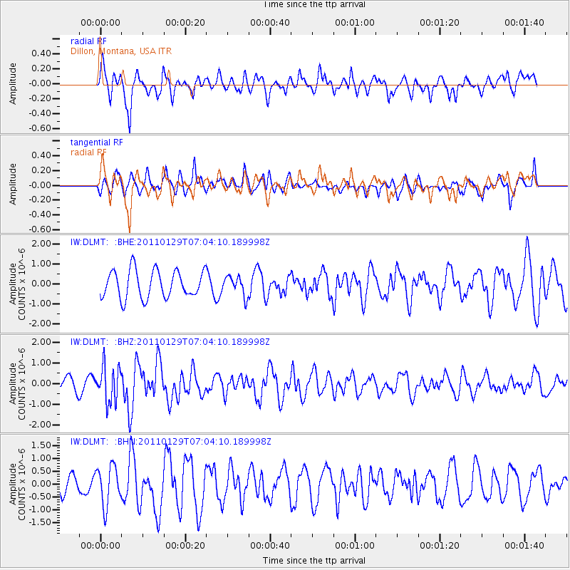
DLMT Dillon, Montana, USA - Earthquake Result Viewer
*The percent match for this event was below the threshold and hence no stack was calculated.
| Earthquake location: |
Jan Mayen Island Region |
| Earthquake latitude/longitude: |
70.9/-6.7 |
| Earthquake time(UTC): |
2011/01/29 (029) 06:55:26 GMT |
| Earthquake Depth: |
6.0 km |
| Earthquake Magnitude: |
6.1 MB, 6.1 MS, 6.2 MW, 6.2 MW |
| Earthquake Catalog/Contributor: |
WHDF/NEIC |
|
| Network: |
IW Intermountain West |
| Station: |
DLMT Dillon, Montana, USA |
| Lat/Lon: |
45.36 N/112.60 W |
| Elevation: |
1569 m |
|
| Distance: |
52.7 deg |
| Az: |
301.511 deg |
| Baz: |
23.413 deg |
| Ray Param: |
$rayparam |
*The percent match for this event was below the threshold and hence was not used in the summary stack. |
|
| Radial Match: |
68.04064 % |
| Radial Bump: |
400 |
| Transverse Match: |
47.476566 % |
| Transverse Bump: |
400 |
| SOD ConfigId: |
350818 |
| Insert Time: |
2011-07-20 07:38:06.464 +0000 |
| GWidth: |
2.5 |
| Max Bumps: |
400 |
| Tol: |
0.001 |
|
Signal To Noise
| Channel | StoN | STA | LTA |
| IW:DLMT: :BHZ:20110129T07:04:10.189998Z | 2.2131314 | 8.808963E-7 | 3.9803163E-7 |
| IW:DLMT: :BHN:20110129T07:04:10.189998Z | 1.3861479 | 7.684332E-7 | 5.5436595E-7 |
| IW:DLMT: :BHE:20110129T07:04:10.189998Z | 0.7144112 | 4.951837E-7 | 6.931354E-7 |
| Arrivals |
| Ps | |
| PpPs | |
| PsPs/PpSs | |


