You are here: Home > Network List > TA - USArray Transportable Network (new EarthScope stations) Stations List
> Station 232A Coleman, TX, USA > Earthquake Result Viewer
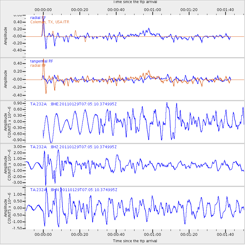
232A Coleman, TX, USA - Earthquake Result Viewer
*The percent match for this event was below the threshold and hence no stack was calculated.
| Earthquake location: |
Jan Mayen Island Region |
| Earthquake latitude/longitude: |
70.9/-6.7 |
| Earthquake time(UTC): |
2011/01/29 (029) 06:55:26 GMT |
| Earthquake Depth: |
6.0 km |
| Earthquake Magnitude: |
6.1 MB, 6.1 MS, 6.2 MW, 6.2 MW |
| Earthquake Catalog/Contributor: |
WHDF/NEIC |
|
| Network: |
TA USArray Transportable Network (new EarthScope stations) |
| Station: |
232A Coleman, TX, USA |
| Lat/Lon: |
31.89 N/99.65 W |
| Elevation: |
621 m |
|
| Distance: |
61.2 deg |
| Az: |
284.16 deg |
| Baz: |
21.996 deg |
| Ray Param: |
$rayparam |
*The percent match for this event was below the threshold and hence was not used in the summary stack. |
|
| Radial Match: |
77.81406 % |
| Radial Bump: |
400 |
| Transverse Match: |
49.13459 % |
| Transverse Bump: |
399 |
| SOD ConfigId: |
350818 |
| Insert Time: |
2011-07-20 07:59:04.575 +0000 |
| GWidth: |
2.5 |
| Max Bumps: |
400 |
| Tol: |
0.001 |
|
Signal To Noise
| Channel | StoN | STA | LTA |
| TA:232A: :BHZ:20110129T07:05:10.374995Z | 3.633775 | 1.2781153E-6 | 3.517321E-7 |
| TA:232A: :BHN:20110129T07:05:10.374995Z | 2.2818832 | 6.897859E-7 | 3.02288E-7 |
| TA:232A: :BHE:20110129T07:05:10.374995Z | 0.7842564 | 3.2068488E-7 | 4.089031E-7 |
| Arrivals |
| Ps | |
| PpPs | |
| PsPs/PpSs | |


