HWB AZ.HWB - Earthquake Result Viewer
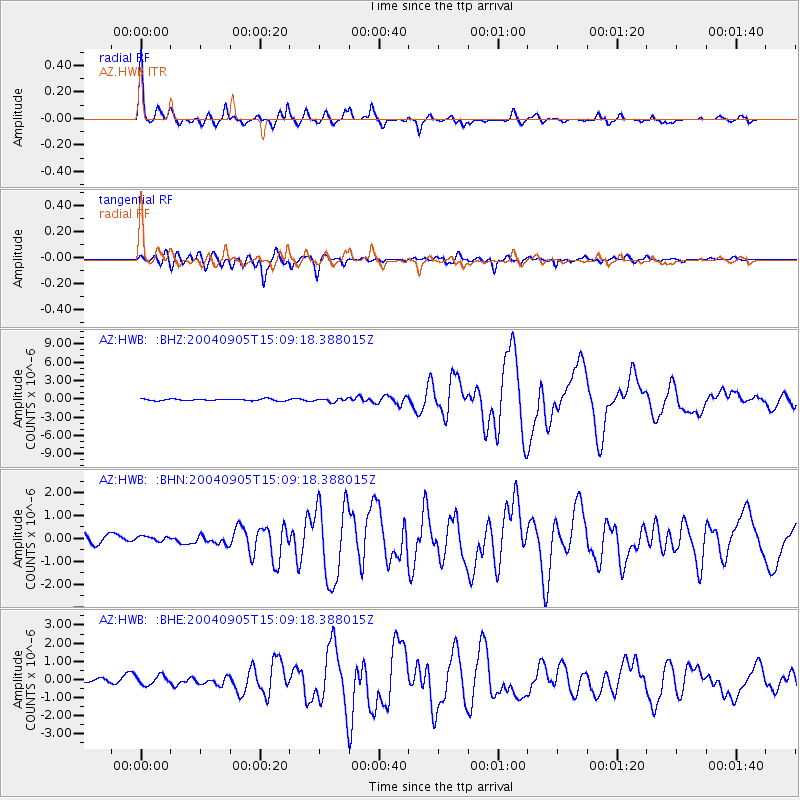
Earthquake location: Near S. Coast Of Honshu, Japan
Earthquake latitude/longitude: 33.2/137.1
Earthquake time(UTC): 2004/09/05 (249) 14:57:18 GMT
Earthquake Depth: 10 km
Earthquake Magnitude: 6.2 MB, 7.1 MS, 7.4 MW, 7.4 MW
Earthquake Catalog/Contributor: WHDF/NEIC
Network: AZ ANZA Regional Network
Station: HWB AZ.HWB
Lat/Lon: 33.03 N/116.96 W
Elevation: 478 m
Distance: 84.2 deg
Az: 54.28 deg
Baz: 305.862 deg
Ray Param: 0.04567546
Estimated Moho Depth: 35.5 km
Estimated Crust Vp/Vs: 1.60
Assumed Crust Vp: 6.264 km/s
Estimated Crust Vs: 3.915 km/s
Estimated Crust Poisson's Ratio: 0.18
Radial Match: 91.5839 %
Radial Bump: 400
Transverse Match: 89.80889 %
Transverse Bump: 400
SOD ConfigId: 2459
Insert Time: 2010-02-26 19:24:45.301 +0000
GWidth: 2.5
Max Bumps: 400
Tol: 0.001

Signal To Noise

ChannelStoNSTALTA
AZ:HWB: :BHN:20040905T15:09:18.388015Z0.76480541.4406316E-71.8836579E-7
AZ:HWB: :BHE:20040905T15:09:18.388015Z2.08991382.6363097E-71.2614441E-7
AZ:HWB: :BHZ:20040905T15:09:18.388015Z1.7842252.532641E-71.4194627E-7
Arrivals
Ps3.5 SECOND
PpPs14 SECOND
PsPs/PpSs18 SECOND