HWB AZ.HWB - Earthquake Result Viewer
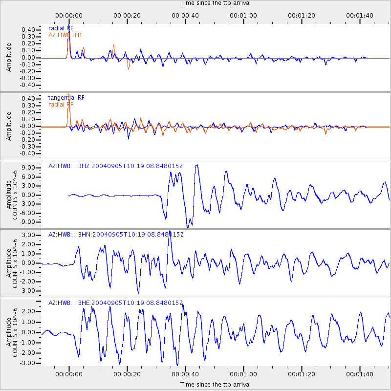
Earthquake location: Near S. Coast Of Western Honshu
Earthquake latitude/longitude: 33.1/136.6
Earthquake time(UTC): 2004/09/05 (249) 10:07:07 GMT
Earthquake Depth: 14 km
Earthquake Magnitude: 6.7 MB, 7.0 MS, 7.2 MW, 7.0 MW
Earthquake Catalog/Contributor: WHDF/NEIC
Network: AZ ANZA Regional Network
Station: HWB AZ.HWB
Lat/Lon: 33.03 N/116.96 W
Elevation: 478 m
Distance: 84.5 deg
Az: 54.046 deg
Baz: 305.993 deg
Ray Param: 0.045403596
Estimated Moho Depth: 48.0 km
Estimated Crust Vp/Vs: 1.60
Assumed Crust Vp: 6.264 km/s
Estimated Crust Vs: 3.915 km/s
Estimated Crust Poisson's Ratio: 0.18
Radial Match: 94.917244 %
Radial Bump: 400
Transverse Match: 88.70883 %
Transverse Bump: 400
SOD ConfigId: 2459
Insert Time: 2010-02-26 19:24:46.323 +0000
GWidth: 2.5
Max Bumps: 400
Tol: 0.001

Signal To Noise

ChannelStoNSTALTA
AZ:HWB: :BHN:20040905T10:19:08.848015Z7.50641168.249401E-71.0989807E-7
AZ:HWB: :BHE:20040905T10:19:08.848015Z5.1596721.0692909E-62.072401E-7
AZ:HWB: :BHZ:20040905T10:19:08.848015Z19.645073.6896736E-61.8781678E-7
Arrivals
Ps4.7 SECOND
PpPs19 SECOND
PsPs/PpSs24 SECOND