You are here: Home > Network List > TA - USArray Transportable Network (new EarthScope stations) Stations List
> Station D28A Regan, ND, USA > Earthquake Result Viewer
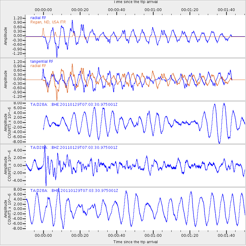
D28A Regan, ND, USA - Earthquake Result Viewer
*The percent match for this event was below the threshold and hence no stack was calculated.
| Earthquake location: |
Jan Mayen Island Region |
| Earthquake latitude/longitude: |
70.9/-6.7 |
| Earthquake time(UTC): |
2011/01/29 (029) 06:55:26 GMT |
| Earthquake Depth: |
6.0 km |
| Earthquake Magnitude: |
6.1 MB, 6.1 MS, 6.2 MW, 6.2 MW |
| Earthquake Catalog/Contributor: |
WHDF/NEIC |
|
| Network: |
TA USArray Transportable Network (new EarthScope stations) |
| Station: |
D28A Regan, ND, USA |
| Lat/Lon: |
47.19 N/100.57 W |
| Elevation: |
621 m |
|
| Distance: |
47.5 deg |
| Az: |
292.657 deg |
| Baz: |
26.4 deg |
| Ray Param: |
$rayparam |
*The percent match for this event was below the threshold and hence was not used in the summary stack. |
|
| Radial Match: |
75.35375 % |
| Radial Bump: |
337 |
| Transverse Match: |
67.97186 % |
| Transverse Bump: |
345 |
| SOD ConfigId: |
350818 |
| Insert Time: |
2011-07-20 08:24:42.541 +0000 |
| GWidth: |
2.5 |
| Max Bumps: |
400 |
| Tol: |
0.001 |
|
Signal To Noise
| Channel | StoN | STA | LTA |
| TA:D28A: :BHZ:20110129T07:03:30.975001Z | 2.5954907 | 2.260914E-6 | 8.710931E-7 |
| TA:D28A: :BHN:20110129T07:03:30.975001Z | 1.0094166 | 3.4220536E-6 | 3.3901301E-6 |
| TA:D28A: :BHE:20110129T07:03:30.975001Z | 1.899603 | 4.364605E-6 | 2.2976405E-6 |
| Arrivals |
| Ps | |
| PpPs | |
| PsPs/PpSs | |


