You are here: Home > Network List > TA - USArray Transportable Network (new EarthScope stations) Stations List
> Station A28A Rude Farm, Bottineau, ND, USA > Earthquake Result Viewer
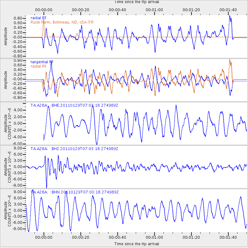
A28A Rude Farm, Bottineau, ND, USA - Earthquake Result Viewer
*The percent match for this event was below the threshold and hence no stack was calculated.
| Earthquake location: |
Jan Mayen Island Region |
| Earthquake latitude/longitude: |
70.9/-6.7 |
| Earthquake time(UTC): |
2011/01/29 (029) 06:55:26 GMT |
| Earthquake Depth: |
6.0 km |
| Earthquake Magnitude: |
6.1 MB, 6.1 MS, 6.2 MW, 6.2 MW |
| Earthquake Catalog/Contributor: |
WHDF/NEIC |
|
| Network: |
TA USArray Transportable Network (new EarthScope stations) |
| Station: |
A28A Rude Farm, Bottineau, ND, USA |
| Lat/Lon: |
48.91 N/100.27 W |
| Elevation: |
692 m |
|
| Distance: |
45.9 deg |
| Az: |
293.472 deg |
| Baz: |
27.183 deg |
| Ray Param: |
$rayparam |
*The percent match for this event was below the threshold and hence was not used in the summary stack. |
|
| Radial Match: |
62.24589 % |
| Radial Bump: |
364 |
| Transverse Match: |
66.81831 % |
| Transverse Bump: |
348 |
| SOD ConfigId: |
350818 |
| Insert Time: |
2011-07-20 08:26:53.919 +0000 |
| GWidth: |
2.5 |
| Max Bumps: |
400 |
| Tol: |
0.001 |
|
Signal To Noise
| Channel | StoN | STA | LTA |
| TA:A28A: :BHZ:20110129T07:03:18.274989Z | 7.1637793 | 3.7564835E-6 | 5.243717E-7 |
| TA:A28A: :BHN:20110129T07:03:18.274989Z | 0.57844424 | 2.4868405E-6 | 4.299188E-6 |
| TA:A28A: :BHE:20110129T07:03:18.274989Z | 1.4403056 | 3.0747342E-6 | 2.134779E-6 |
| Arrivals |
| Ps | |
| PpPs | |
| PsPs/PpSs | |


