You are here: Home > Network List > TA - USArray Transportable Network (new EarthScope stations) Stations List
> Station E30A Jud, ND, USA > Earthquake Result Viewer
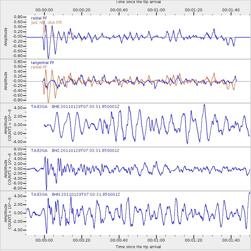
E30A Jud, ND, USA - Earthquake Result Viewer
*The percent match for this event was below the threshold and hence no stack was calculated.
| Earthquake location: |
Jan Mayen Island Region |
| Earthquake latitude/longitude: |
70.9/-6.7 |
| Earthquake time(UTC): |
2011/01/29 (029) 06:55:26 GMT |
| Earthquake Depth: |
6.0 km |
| Earthquake Magnitude: |
6.1 MB, 6.1 MS, 6.2 MW, 6.2 MW |
| Earthquake Catalog/Contributor: |
WHDF/NEIC |
|
| Network: |
TA USArray Transportable Network (new EarthScope stations) |
| Station: |
E30A Jud, ND, USA |
| Lat/Lon: |
46.50 N/98.91 W |
| Elevation: |
544 m |
|
| Distance: |
47.6 deg |
| Az: |
290.858 deg |
| Baz: |
26.393 deg |
| Ray Param: |
$rayparam |
*The percent match for this event was below the threshold and hence was not used in the summary stack. |
|
| Radial Match: |
77.293724 % |
| Radial Bump: |
400 |
| Transverse Match: |
67.22417 % |
| Transverse Bump: |
331 |
| SOD ConfigId: |
350818 |
| Insert Time: |
2011-07-20 08:29:26.118 +0000 |
| GWidth: |
2.5 |
| Max Bumps: |
400 |
| Tol: |
0.001 |
|
Signal To Noise
| Channel | StoN | STA | LTA |
| TA:E30A: :BHZ:20110129T07:03:31.850001Z | 4.0268507 | 2.8959817E-6 | 7.191679E-7 |
| TA:E30A: :BHN:20110129T07:03:31.850001Z | 1.744428 | 2.052432E-6 | 1.1765644E-6 |
| TA:E30A: :BHE:20110129T07:03:31.850001Z | 0.637289 | 1.0648431E-6 | 1.6708951E-6 |
| Arrivals |
| Ps | |
| PpPs | |
| PsPs/PpSs | |


