You are here: Home > Network List > TA - USArray Transportable Network (new EarthScope stations) Stations List
> Station Y39A Lockesburg, AR, USA > Earthquake Result Viewer
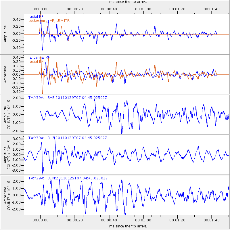
Y39A Lockesburg, AR, USA - Earthquake Result Viewer
*The percent match for this event was below the threshold and hence no stack was calculated.
| Earthquake location: |
Jan Mayen Island Region |
| Earthquake latitude/longitude: |
70.9/-6.7 |
| Earthquake time(UTC): |
2011/01/29 (029) 06:55:26 GMT |
| Earthquake Depth: |
6.0 km |
| Earthquake Magnitude: |
6.1 MB, 6.1 MS, 6.2 MW, 6.2 MW |
| Earthquake Catalog/Contributor: |
WHDF/NEIC |
|
| Network: |
TA USArray Transportable Network (new EarthScope stations) |
| Station: |
Y39A Lockesburg, AR, USA |
| Lat/Lon: |
33.94 N/94.09 W |
| Elevation: |
108 m |
|
| Distance: |
57.5 deg |
| Az: |
280.049 deg |
| Baz: |
22.903 deg |
| Ray Param: |
$rayparam |
*The percent match for this event was below the threshold and hence was not used in the summary stack. |
|
| Radial Match: |
69.235 % |
| Radial Bump: |
400 |
| Transverse Match: |
45.26735 % |
| Transverse Bump: |
397 |
| SOD ConfigId: |
350818 |
| Insert Time: |
2011-07-20 09:07:11.934 +0000 |
| GWidth: |
2.5 |
| Max Bumps: |
400 |
| Tol: |
0.001 |
|
Signal To Noise
| Channel | StoN | STA | LTA |
| TA:Y39A: :BHZ:20110129T07:04:45.02502Z | 2.458947 | 1.5315583E-6 | 6.228513E-7 |
| TA:Y39A: :BHN:20110129T07:04:45.02502Z | 1.1085722 | 7.6194425E-7 | 6.873203E-7 |
| TA:Y39A: :BHE:20110129T07:04:45.02502Z | 1.9317932 | 7.659677E-7 | 3.9650604E-7 |
| Arrivals |
| Ps | |
| PpPs | |
| PsPs/PpSs | |


