You are here: Home > Network List > TA - USArray Transportable Network (new EarthScope stations) Stations List
> Station O36A Bolckow, MO, USA > Earthquake Result Viewer
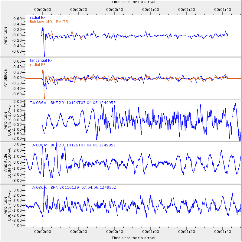
O36A Bolckow, MO, USA - Earthquake Result Viewer
*The percent match for this event was below the threshold and hence no stack was calculated.
| Earthquake location: |
Jan Mayen Island Region |
| Earthquake latitude/longitude: |
70.9/-6.7 |
| Earthquake time(UTC): |
2011/01/29 (029) 06:55:26 GMT |
| Earthquake Depth: |
6.0 km |
| Earthquake Magnitude: |
6.1 MB, 6.1 MS, 6.2 MW, 6.2 MW |
| Earthquake Catalog/Contributor: |
WHDF/NEIC |
|
| Network: |
TA USArray Transportable Network (new EarthScope stations) |
| Station: |
O36A Bolckow, MO, USA |
| Lat/Lon: |
40.13 N/94.96 W |
| Elevation: |
306 m |
|
| Distance: |
52.1 deg |
| Az: |
283.875 deg |
| Baz: |
24.587 deg |
| Ray Param: |
$rayparam |
*The percent match for this event was below the threshold and hence was not used in the summary stack. |
|
| Radial Match: |
55.22206 % |
| Radial Bump: |
400 |
| Transverse Match: |
68.45188 % |
| Transverse Bump: |
400 |
| SOD ConfigId: |
350818 |
| Insert Time: |
2011-07-20 09:11:31.254 +0000 |
| GWidth: |
2.5 |
| Max Bumps: |
400 |
| Tol: |
0.001 |
|
Signal To Noise
| Channel | StoN | STA | LTA |
| TA:O36A: :BHZ:20110129T07:04:06.124995Z | 2.919702 | 1.4606898E-6 | 5.0028723E-7 |
| TA:O36A: :BHN:20110129T07:04:06.124995Z | 2.6619227 | 1.5065386E-6 | 5.659589E-7 |
| TA:O36A: :BHE:20110129T07:04:06.124995Z | 1.6578467 | 9.886601E-7 | 5.9635187E-7 |
| Arrivals |
| Ps | |
| PpPs | |
| PsPs/PpSs | |


