You are here: Home > Network List > TA - USArray Transportable Network (new EarthScope stations) Stations List
> Station M35A Neola, IA, USA > Earthquake Result Viewer
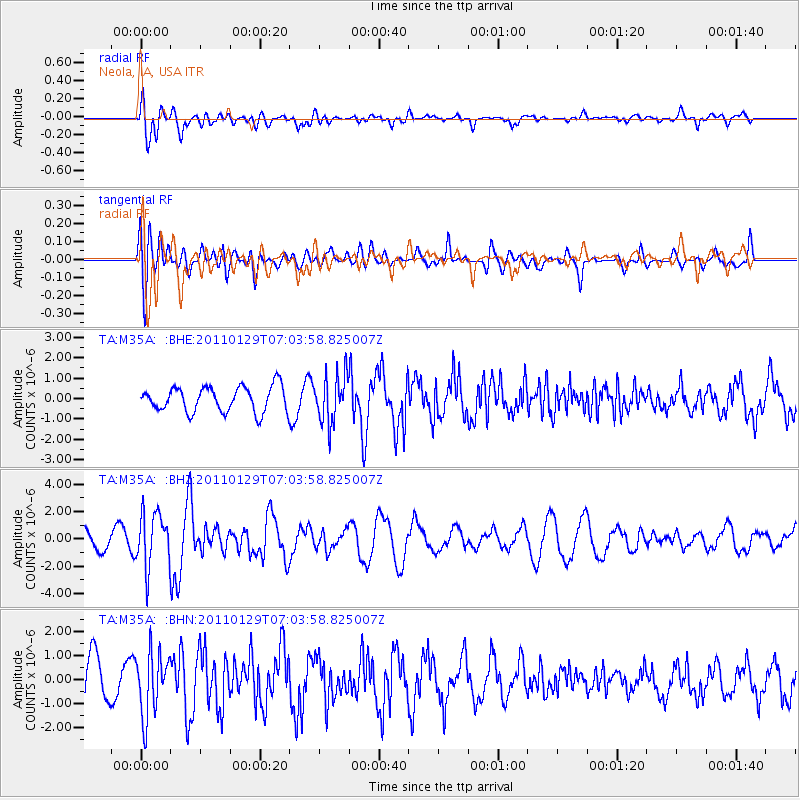
M35A Neola, IA, USA - Earthquake Result Viewer
*The percent match for this event was below the threshold and hence no stack was calculated.
| Earthquake location: |
Jan Mayen Island Region |
| Earthquake latitude/longitude: |
70.9/-6.7 |
| Earthquake time(UTC): |
2011/01/29 (029) 06:55:26 GMT |
| Earthquake Depth: |
6.0 km |
| Earthquake Magnitude: |
6.1 MB, 6.1 MS, 6.2 MW, 6.2 MW |
| Earthquake Catalog/Contributor: |
WHDF/NEIC |
|
| Network: |
TA USArray Transportable Network (new EarthScope stations) |
| Station: |
M35A Neola, IA, USA |
| Lat/Lon: |
41.47 N/95.69 W |
| Elevation: |
363 m |
|
| Distance: |
51.1 deg |
| Az: |
285.229 deg |
| Baz: |
24.952 deg |
| Ray Param: |
$rayparam |
*The percent match for this event was below the threshold and hence was not used in the summary stack. |
|
| Radial Match: |
68.974655 % |
| Radial Bump: |
400 |
| Transverse Match: |
63.60273 % |
| Transverse Bump: |
400 |
| SOD ConfigId: |
350818 |
| Insert Time: |
2011-07-20 09:16:20.538 +0000 |
| GWidth: |
2.5 |
| Max Bumps: |
400 |
| Tol: |
0.001 |
|
Signal To Noise
| Channel | StoN | STA | LTA |
| TA:M35A: :BHZ:20110129T07:03:58.825007Z | 2.7568562 | 1.9966224E-6 | 7.242389E-7 |
| TA:M35A: :BHN:20110129T07:03:58.825007Z | 1.2810761 | 1.3155186E-6 | 1.0268856E-6 |
| TA:M35A: :BHE:20110129T07:03:58.825007Z | 1.8990687 | 1.1702862E-6 | 6.162422E-7 |
| Arrivals |
| Ps | |
| PpPs | |
| PsPs/PpSs | |


