
HWB AZ.HWB - Earthquake Result Viewer
| ||||||||||||||||||
| ||||||||||||||||||
| ||||||||||||||||||
|
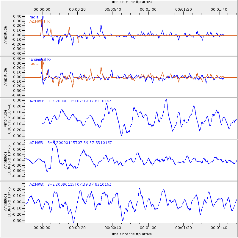
Signal To Noise
| Channel | StoN | STA | LTA |
| AZ:HWB: :BHN:20090115T07:39:37.831016Z | 4.6371183 | 3.5099654E-7 | 7.569282E-8 |
| AZ:HWB: :BHE:20090115T07:39:37.831016Z | 1.4777483 | 8.066869E-8 | 5.4588927E-8 |
| AZ:HWB: :BHZ:20090115T07:39:37.831016Z | 1.5002066 | 9.5952984E-8 | 6.3959845E-8 |
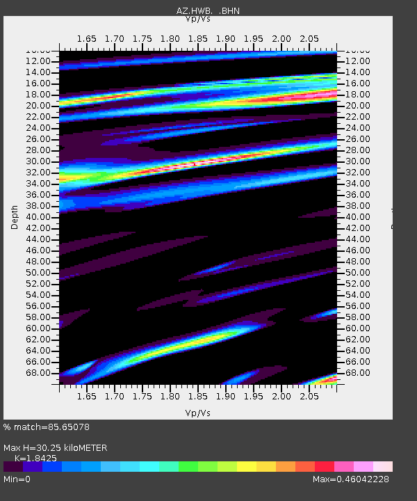
| Arrivals | |
| Ps | 4.2 SECOND |
| PpPs | 13 SECOND |
| PsPs/PpSs | 18 SECOND |

