You are here: Home > Network List > US - United States National Seismic Network Stations List
> Station WMOK Wichita Mountains, Oklahoma, USA > Earthquake Result Viewer
WMOK Wichita Mountains, Oklahoma, USA - Earthquake Result Viewer
*The percent match for this event was below the threshold and hence no stack was calculated.
| Earthquake location: |
Jan Mayen Island Region |
| Earthquake latitude/longitude: |
70.9/-6.7 |
| Earthquake time(UTC): |
2011/01/29 (029) 06:55:26 GMT |
| Earthquake Depth: |
6.0 km |
| Earthquake Magnitude: |
6.1 MB, 6.1 MS, 6.2 MW, 6.2 MW |
| Earthquake Catalog/Contributor: |
WHDF/NEIC |
|
| Network: |
US United States National Seismic Network |
| Station: |
WMOK Wichita Mountains, Oklahoma, USA |
| Lat/Lon: |
34.74 N/98.78 W |
| Elevation: |
486 m |
|
| Distance: |
58.3 deg |
| Az: |
284.635 deg |
| Baz: |
22.708 deg |
| Ray Param: |
$rayparam |
*The percent match for this event was below the threshold and hence was not used in the summary stack. |
|
| Radial Match: |
52.4388 % |
| Radial Bump: |
400 |
| Transverse Match: |
68.009735 % |
| Transverse Bump: |
378 |
| SOD ConfigId: |
350818 |
| Insert Time: |
2011-07-20 09:57:48.593 +0000 |
| GWidth: |
2.5 |
| Max Bumps: |
400 |
| Tol: |
0.001 |
|
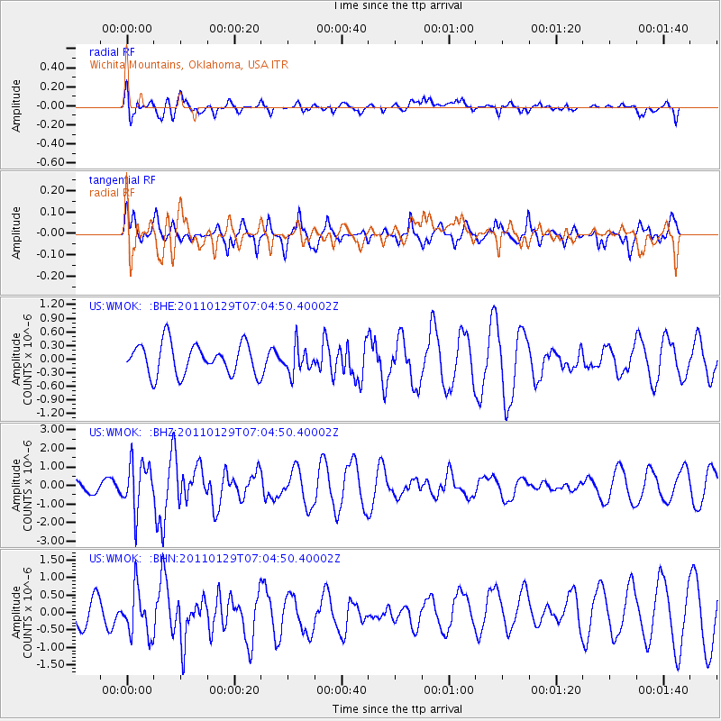
Signal To Noise
| Channel | StoN | STA | LTA |
| US:WMOK: :BHZ:20110129T07:04:50.40002Z | 4.128536 | 1.2920293E-6 | 3.1295096E-7 |
| US:WMOK: :BHN:20110129T07:04:50.40002Z | 2.1380882 | 6.9255924E-7 | 3.2391517E-7 |
| US:WMOK: :BHE:20110129T07:04:50.40002Z | 0.8740588 | 2.9747923E-7 | 3.4034235E-7 |
| Arrivals |
| Ps | |
| PpPs | |
| PsPs/PpSs | |


