You are here: Home > Network List > US - United States National Seismic Network Stations List
> Station EGMT Eagleton, Montana, USA > Earthquake Result Viewer
EGMT Eagleton, Montana, USA - Earthquake Result Viewer
*The percent match for this event was below the threshold and hence no stack was calculated.
| Earthquake location: |
Jan Mayen Island Region |
| Earthquake latitude/longitude: |
70.9/-6.7 |
| Earthquake time(UTC): |
2011/01/29 (029) 06:55:26 GMT |
| Earthquake Depth: |
6.0 km |
| Earthquake Magnitude: |
6.1 MB, 6.1 MS, 6.2 MW, 6.2 MW |
| Earthquake Catalog/Contributor: |
WHDF/NEIC |
|
| Network: |
US United States National Seismic Network |
| Station: |
EGMT Eagleton, Montana, USA |
| Lat/Lon: |
48.02 N/109.75 W |
| Elevation: |
1055 m |
|
| Distance: |
49.4 deg |
| Az: |
300.618 deg |
| Baz: |
24.913 deg |
| Ray Param: |
$rayparam |
*The percent match for this event was below the threshold and hence was not used in the summary stack. |
|
| Radial Match: |
69.44143 % |
| Radial Bump: |
400 |
| Transverse Match: |
56.529346 % |
| Transverse Bump: |
400 |
| SOD ConfigId: |
350818 |
| Insert Time: |
2011-07-20 10:06:53.121 +0000 |
| GWidth: |
2.5 |
| Max Bumps: |
400 |
| Tol: |
0.001 |
|
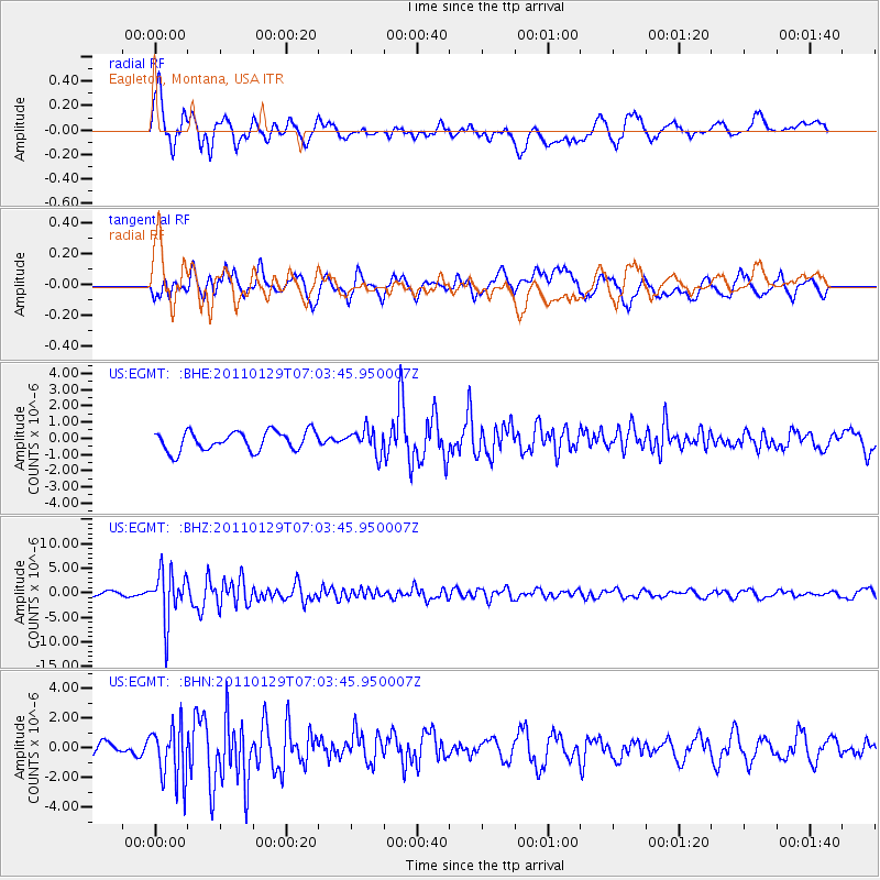
Signal To Noise
| Channel | StoN | STA | LTA |
| US:EGMT: :BHZ:20110129T07:03:45.950007Z | 11.695556 | 5.018297E-6 | 4.2907726E-7 |
| US:EGMT: :BHN:20110129T07:03:45.950007Z | 1.8549618 | 1.912428E-6 | 1.0309797E-6 |
| US:EGMT: :BHE:20110129T07:03:45.950007Z | 1.2481217 | 7.3977895E-7 | 5.927137E-7 |
| Arrivals |
| Ps | |
| PpPs | |
| PsPs/PpSs | |


