You are here: Home > Network List > US - United States National Seismic Network Stations List
> Station BRAL Brewton, Alabama, USA > Earthquake Result Viewer
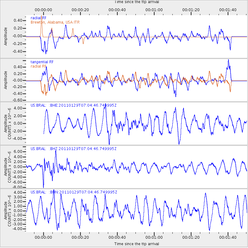
BRAL Brewton, Alabama, USA - Earthquake Result Viewer
*The percent match for this event was below the threshold and hence no stack was calculated.
| Earthquake location: |
Jan Mayen Island Region |
| Earthquake latitude/longitude: |
70.9/-6.7 |
| Earthquake time(UTC): |
2011/01/29 (029) 06:55:26 GMT |
| Earthquake Depth: |
6.0 km |
| Earthquake Magnitude: |
6.1 MB, 6.1 MS, 6.2 MW, 6.2 MW |
| Earthquake Catalog/Contributor: |
WHDF/NEIC |
|
| Network: |
US United States National Seismic Network |
| Station: |
BRAL Brewton, Alabama, USA |
| Lat/Lon: |
31.01 N/87.06 W |
| Elevation: |
61 m |
|
| Distance: |
57.9 deg |
| Az: |
272.227 deg |
| Baz: |
22.484 deg |
| Ray Param: |
$rayparam |
*The percent match for this event was below the threshold and hence was not used in the summary stack. |
|
| Radial Match: |
59.607746 % |
| Radial Bump: |
400 |
| Transverse Match: |
57.71013 % |
| Transverse Bump: |
400 |
| SOD ConfigId: |
350818 |
| Insert Time: |
2011-07-20 10:08:42.542 +0000 |
| GWidth: |
2.5 |
| Max Bumps: |
400 |
| Tol: |
0.001 |
|
Signal To Noise
| Channel | StoN | STA | LTA |
| US:BRAL: :BHZ:20110129T07:04:46.749995Z | 3.0899153 | 2.7555636E-6 | 8.917926E-7 |
| US:BRAL: :BHN:20110129T07:04:46.749995Z | 0.92386794 | 1.5030453E-6 | 1.6269049E-6 |
| US:BRAL: :BHE:20110129T07:04:46.749995Z | 1.8530985 | 3.0737071E-6 | 1.6586852E-6 |
| Arrivals |
| Ps | |
| PpPs | |
| PsPs/PpSs | |


