You are here: Home > Network List > TA - USArray Transportable Network (new EarthScope stations) Stations List
> Station 109C Camp Elliot, Mirimar, CA, USA > Earthquake Result Viewer
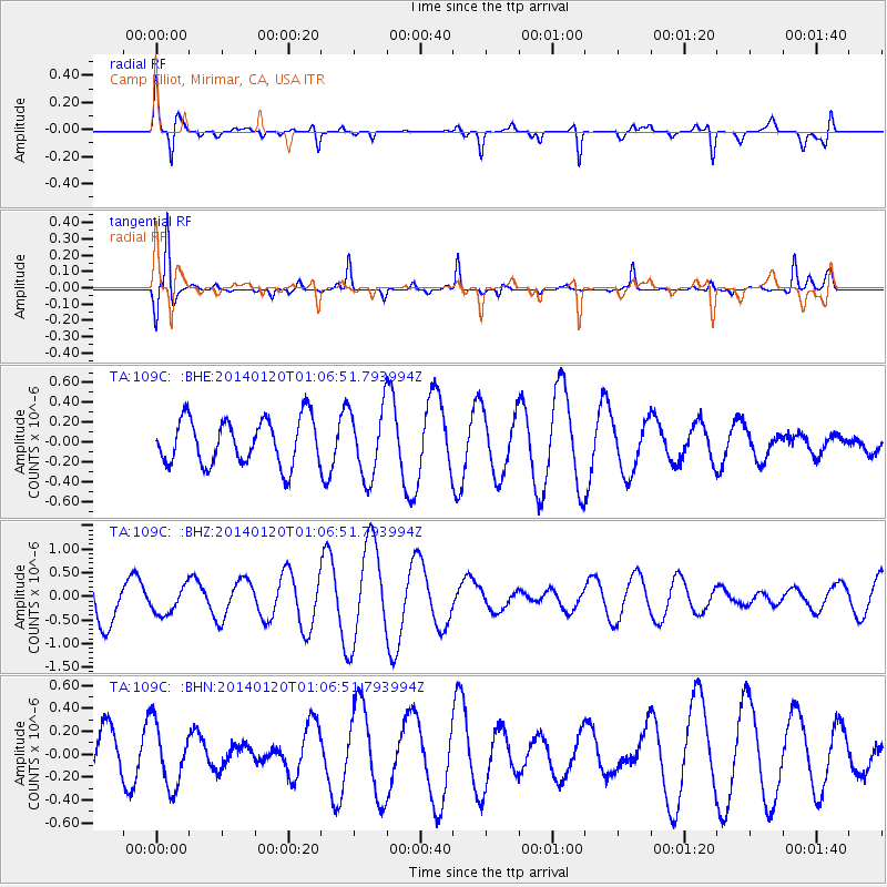
109C Camp Elliot, Mirimar, CA, USA - Earthquake Result Viewer
*The percent match for this event was below the threshold and hence no stack was calculated.
| Earthquake location: |
Kuril Islands |
| Earthquake latitude/longitude: |
46.4/153.4 |
| Earthquake time(UTC): |
2014/01/20 (020) 00:56:36 GMT |
| Earthquake Depth: |
43 km |
| Earthquake Magnitude: |
4.8 mb |
| Earthquake Catalog/Contributor: |
ISC/ISC |
|
| Network: |
TA USArray Transportable Network (new EarthScope stations) |
| Station: |
109C Camp Elliot, Mirimar, CA, USA |
| Lat/Lon: |
32.89 N/117.11 W |
| Elevation: |
150 m |
|
| Distance: |
66.7 deg |
| Az: |
66.374 deg |
| Baz: |
311.157 deg |
| Ray Param: |
$rayparam |
*The percent match for this event was below the threshold and hence was not used in the summary stack. |
|
| Radial Match: |
69.98284 % |
| Radial Bump: |
400 |
| Transverse Match: |
62.110332 % |
| Transverse Bump: |
288 |
| SOD ConfigId: |
3390531 |
| Insert Time: |
2019-04-10 01:25:12.583 +0000 |
| GWidth: |
2.5 |
| Max Bumps: |
400 |
| Tol: |
0.001 |
|
Signal To Noise
| Channel | StoN | STA | LTA |
| TA:109C: :BHZ:20140120T01:06:51.793994Z | 0.47772205 | 2.859748E-7 | 5.9862174E-7 |
| TA:109C: :BHN:20140120T01:06:51.793994Z | 1.186043 | 2.6928808E-7 | 2.2704747E-7 |
| TA:109C: :BHE:20140120T01:06:51.793994Z | 1.5026629 | 3.4657916E-7 | 2.3064332E-7 |
| Arrivals |
| Ps | |
| PpPs | |
| PsPs/PpSs | |


