HWB AZ.HWB - Earthquake Result Viewer
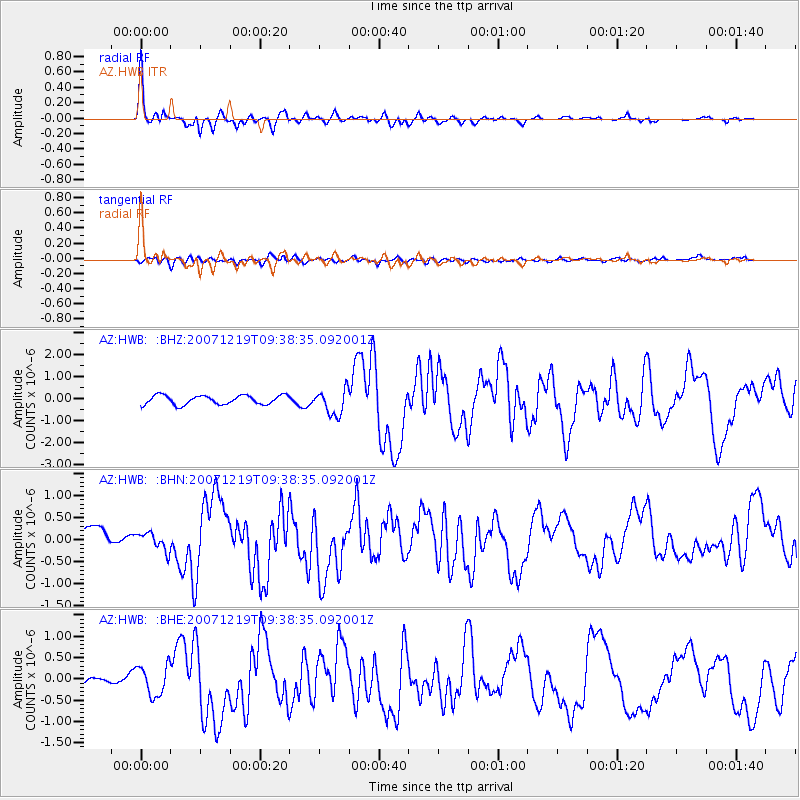
Earthquake location: Andreanof Islands, Aleutian Is.
Earthquake latitude/longitude: 51.4/-179.5
Earthquake time(UTC): 2007/12/19 (353) 09:30:27 GMT
Earthquake Depth: 29 km
Earthquake Magnitude: 6.4 MB, 7.1 MS, 7.1 MW, 7.0 MW
Earthquake Catalog/Contributor: WHDF/NEIC
Network: AZ ANZA Regional Network
Station: HWB AZ.HWB
Lat/Lon: 33.03 N/116.96 W
Elevation: 478 m
Distance: 48.3 deg
Az: 87.043 deg
Baz: 311.816 deg
Ray Param: 0.06940092
Estimated Moho Depth: 34.0 km
Estimated Crust Vp/Vs: 1.66
Assumed Crust Vp: 6.264 km/s
Estimated Crust Vs: 3.762 km/s
Estimated Crust Poisson's Ratio: 0.22
Radial Match: 93.76478 %
Radial Bump: 400
Transverse Match: 74.047935 %
Transverse Bump: 400
SOD ConfigId: 2564
Insert Time: 2010-02-26 19:25:33.554 +0000
GWidth: 2.5
Max Bumps: 400
Tol: 0.001

Signal To Noise

ChannelStoNSTALTA
AZ:HWB: :BHN:20071219T09:38:35.092001Z0.81677362.0122494E-72.4636563E-7
AZ:HWB: :BHE:20071219T09:38:35.092001Z5.93044043.524574E-75.9431905E-8
AZ:HWB: :BHZ:20071219T09:38:35.092001Z2.82967935.753751E-72.0333582E-7
Arrivals
Ps3.8 SECOND
PpPs14 SECOND
PsPs/PpSs17 SECOND