You are here: Home > Network List > UW - Pacific Northwest Regional Seismic Network Stations List
> Station LEBA Lebam, WA, USA > Earthquake Result Viewer
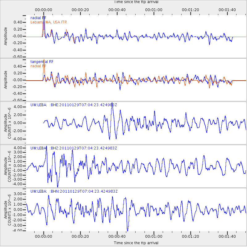
LEBA Lebam, WA, USA - Earthquake Result Viewer
*The percent match for this event was below the threshold and hence no stack was calculated.
| Earthquake location: |
Jan Mayen Island Region |
| Earthquake latitude/longitude: |
70.9/-6.7 |
| Earthquake time(UTC): |
2011/01/29 (029) 06:55:26 GMT |
| Earthquake Depth: |
6.0 km |
| Earthquake Magnitude: |
6.1 MB, 6.1 MS, 6.2 MW, 6.2 MW |
| Earthquake Catalog/Contributor: |
WHDF/NEIC |
|
| Network: |
UW Pacific Northwest Regional Seismic Network |
| Station: |
LEBA Lebam, WA, USA |
| Lat/Lon: |
46.55 N/123.56 W |
| Elevation: |
73 m |
|
| Distance: |
54.5 deg |
| Az: |
310.862 deg |
| Baz: |
21.103 deg |
| Ray Param: |
$rayparam |
*The percent match for this event was below the threshold and hence was not used in the summary stack. |
|
| Radial Match: |
65.866295 % |
| Radial Bump: |
400 |
| Transverse Match: |
59.856323 % |
| Transverse Bump: |
400 |
| SOD ConfigId: |
350818 |
| Insert Time: |
2011-07-20 10:12:05.869 +0000 |
| GWidth: |
2.5 |
| Max Bumps: |
400 |
| Tol: |
0.001 |
|
Signal To Noise
| Channel | StoN | STA | LTA |
| UW:LEBA: :BHZ:20110129T07:04:23.424983Z | 3.4223678 | 2.1094618E-6 | 6.1637496E-7 |
| UW:LEBA: :BHN:20110129T07:04:23.424983Z | 2.4170082 | 1.4151072E-6 | 5.854789E-7 |
| UW:LEBA: :BHE:20110129T07:04:23.424983Z | 1.3880771 | 1.1576464E-6 | 8.3399283E-7 |
| Arrivals |
| Ps | |
| PpPs | |
| PsPs/PpSs | |


