You are here: Home > Network List > TA - USArray Transportable Network (new EarthScope stations) Stations List
> Station TPFO Pinon Flats, CA, USA > Earthquake Result Viewer
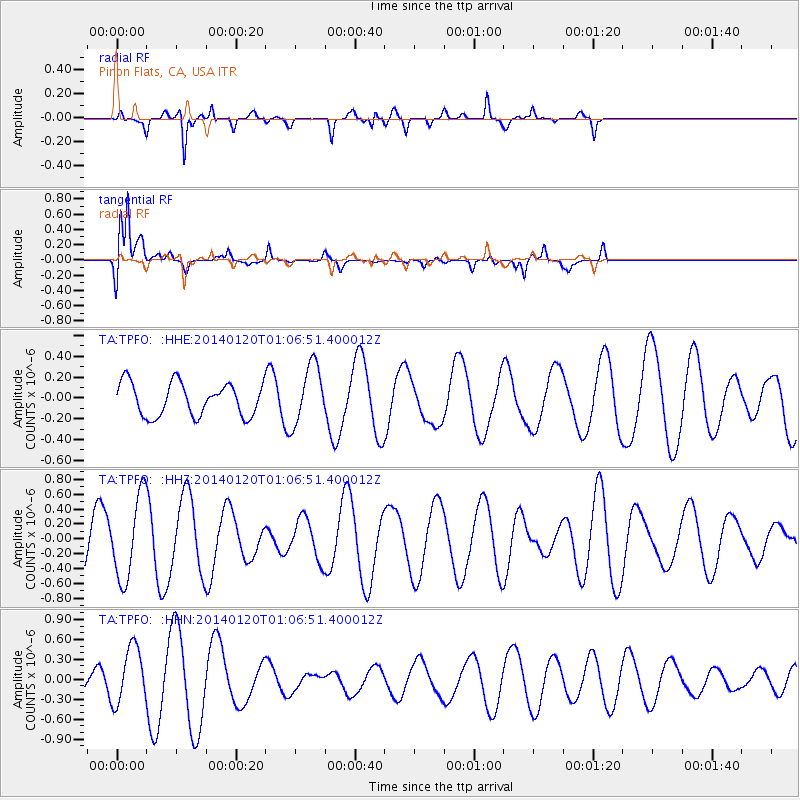
TPFO Pinon Flats, CA, USA - Earthquake Result Viewer
*The percent match for this event was below the threshold and hence no stack was calculated.
| Earthquake location: |
Kuril Islands |
| Earthquake latitude/longitude: |
46.4/153.4 |
| Earthquake time(UTC): |
2014/01/20 (020) 00:56:36 GMT |
| Earthquake Depth: |
43 km |
| Earthquake Magnitude: |
4.8 mb |
| Earthquake Catalog/Contributor: |
ISC/ISC |
|
| Network: |
TA USArray Transportable Network (new EarthScope stations) |
| Station: |
TPFO Pinon Flats, CA, USA |
| Lat/Lon: |
33.61 N/116.45 W |
| Elevation: |
1275 m |
|
| Distance: |
66.6 deg |
| Az: |
65.397 deg |
| Baz: |
311.124 deg |
| Ray Param: |
$rayparam |
*The percent match for this event was below the threshold and hence was not used in the summary stack. |
|
| Radial Match: |
83.718895 % |
| Radial Bump: |
387 |
| Transverse Match: |
86.68425 % |
| Transverse Bump: |
400 |
| SOD ConfigId: |
3390531 |
| Insert Time: |
2019-04-10 01:26:13.302 +0000 |
| GWidth: |
2.5 |
| Max Bumps: |
400 |
| Tol: |
0.001 |
|
Signal To Noise
| Channel | StoN | STA | LTA |
| TA:TPFO: :HHZ:20140120T01:06:51.400012Z | 1.857014 | 5.5273006E-7 | 2.9764453E-7 |
| TA:TPFO: :HHN:20140120T01:06:51.400012Z | 2.0547588 | 4.265527E-7 | 2.0759259E-7 |
| TA:TPFO: :HHE:20140120T01:06:51.400012Z | 1.8180181 | 2.8633735E-7 | 1.5749974E-7 |
| Arrivals |
| Ps | |
| PpPs | |
| PsPs/PpSs | |


