You are here: Home > Network List > BK - Berkeley Digital Seismograph Network Stations List
> Station HUMO Hull Mountain, OR > Earthquake Result Viewer
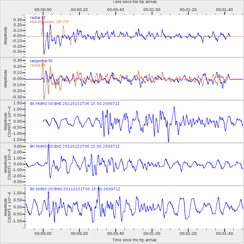
HUMO Hull Mountain, OR - Earthquake Result Viewer
*The percent match for this event was below the threshold and hence no stack was calculated.
| Earthquake location: |
Tonga Islands Region |
| Earthquake latitude/longitude: |
-22.0/-175.6 |
| Earthquake time(UTC): |
2011/01/31 (031) 06:03:27 GMT |
| Earthquake Depth: |
76 km |
| Earthquake Magnitude: |
6.0 MB, 6.0 MW, 6.0 MW |
| Earthquake Catalog/Contributor: |
WHDF/NEIC |
|
| Network: |
BK Berkeley Digital Seismograph Network |
| Station: |
HUMO Hull Mountain, OR |
| Lat/Lon: |
42.61 N/122.96 W |
| Elevation: |
555 m |
|
| Distance: |
80.5 deg |
| Az: |
36.518 deg |
| Baz: |
228.418 deg |
| Ray Param: |
$rayparam |
*The percent match for this event was below the threshold and hence was not used in the summary stack. |
|
| Radial Match: |
79.92133 % |
| Radial Bump: |
400 |
| Transverse Match: |
67.67817 % |
| Transverse Bump: |
400 |
| SOD ConfigId: |
350818 |
| Insert Time: |
2011-07-20 10:52:04.261 +0000 |
| GWidth: |
2.5 |
| Max Bumps: |
400 |
| Tol: |
0.001 |
|
Signal To Noise
| Channel | StoN | STA | LTA |
| BK:HUMO:00:BHZ:20110131T06:15:00.269971Z | 2.9137034 | 1.3137867E-6 | 4.5089925E-7 |
| BK:HUMO:00:BHN:20110131T06:15:00.269971Z | 1.836075 | 4.478774E-7 | 2.43932E-7 |
| BK:HUMO:00:BHE:20110131T06:15:00.269971Z | 1.9147549 | 4.7472128E-7 | 2.4792797E-7 |
| Arrivals |
| Ps | |
| PpPs | |
| PsPs/PpSs | |


