You are here: Home > Network List > CI - Caltech Regional Seismic Network Stations List
> Station BAR Barrett, Tecate, CA, USA > Earthquake Result Viewer
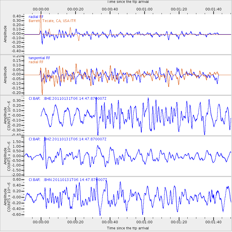
BAR Barrett, Tecate, CA, USA - Earthquake Result Viewer
*The percent match for this event was below the threshold and hence no stack was calculated.
| Earthquake location: |
Tonga Islands Region |
| Earthquake latitude/longitude: |
-22.0/-175.6 |
| Earthquake time(UTC): |
2011/01/31 (031) 06:03:27 GMT |
| Earthquake Depth: |
76 km |
| Earthquake Magnitude: |
6.0 MB, 6.0 MW, 6.0 MW |
| Earthquake Catalog/Contributor: |
WHDF/NEIC |
|
| Network: |
CI Caltech Regional Seismic Network |
| Station: |
BAR Barrett, Tecate, CA, USA |
| Lat/Lon: |
32.68 N/116.67 W |
| Elevation: |
521 m |
|
| Distance: |
78.3 deg |
| Az: |
47.556 deg |
| Baz: |
234.293 deg |
| Ray Param: |
$rayparam |
*The percent match for this event was below the threshold and hence was not used in the summary stack. |
|
| Radial Match: |
75.48568 % |
| Radial Bump: |
400 |
| Transverse Match: |
66.400764 % |
| Transverse Bump: |
400 |
| SOD ConfigId: |
350818 |
| Insert Time: |
2011-07-20 10:55:51.629 +0000 |
| GWidth: |
2.5 |
| Max Bumps: |
400 |
| Tol: |
0.001 |
|
Signal To Noise
| Channel | StoN | STA | LTA |
| CI:BAR: :BHZ:20110131T06:14:47.870007Z | 2.8058069 | 7.943515E-7 | 2.8310984E-7 |
| CI:BAR: :BHN:20110131T06:14:47.870007Z | 1.8110307 | 1.6241677E-7 | 8.9681954E-8 |
| CI:BAR: :BHE:20110131T06:14:47.870007Z | 1.3726895 | 1.7166272E-7 | 1.2505575E-7 |
| Arrivals |
| Ps | |
| PpPs | |
| PsPs/PpSs | |


