You are here: Home > Network List > CI - Caltech Regional Seismic Network Stations List
> Station LGU LGU, Camarillo, CA, USA > Earthquake Result Viewer
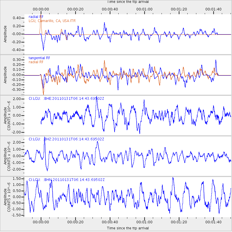
LGU LGU, Camarillo, CA, USA - Earthquake Result Viewer
*The percent match for this event was below the threshold and hence no stack was calculated.
| Earthquake location: |
Tonga Islands Region |
| Earthquake latitude/longitude: |
-22.0/-175.6 |
| Earthquake time(UTC): |
2011/01/31 (031) 06:03:27 GMT |
| Earthquake Depth: |
76 km |
| Earthquake Magnitude: |
6.0 MB, 6.0 MW, 6.0 MW |
| Earthquake Catalog/Contributor: |
WHDF/NEIC |
|
| Network: |
CI Caltech Regional Seismic Network |
| Station: |
LGU LGU, Camarillo, CA, USA |
| Lat/Lon: |
34.11 N/119.07 W |
| Elevation: |
416 m |
|
| Distance: |
77.5 deg |
| Az: |
45.165 deg |
| Baz: |
232.479 deg |
| Ray Param: |
$rayparam |
*The percent match for this event was below the threshold and hence was not used in the summary stack. |
|
| Radial Match: |
60.787567 % |
| Radial Bump: |
400 |
| Transverse Match: |
58.262417 % |
| Transverse Bump: |
400 |
| SOD ConfigId: |
350818 |
| Insert Time: |
2011-07-20 11:06:14.449 +0000 |
| GWidth: |
2.5 |
| Max Bumps: |
400 |
| Tol: |
0.001 |
|
Signal To Noise
| Channel | StoN | STA | LTA |
| CI:LGU: :BHZ:20110131T06:14:43.69502Z | 2.847128 | 1.2330229E-6 | 4.3307605E-7 |
| CI:LGU: :BHN:20110131T06:14:43.69502Z | 1.2204708 | 5.608979E-7 | 4.59575E-7 |
| CI:LGU: :BHE:20110131T06:14:43.69502Z | 2.518115 | 1.0597769E-6 | 4.208612E-7 |
| Arrivals |
| Ps | |
| PpPs | |
| PsPs/PpSs | |


