You are here: Home > Network List > CI - Caltech Regional Seismic Network Stations List
> Station MUR Murrieta > Earthquake Result Viewer
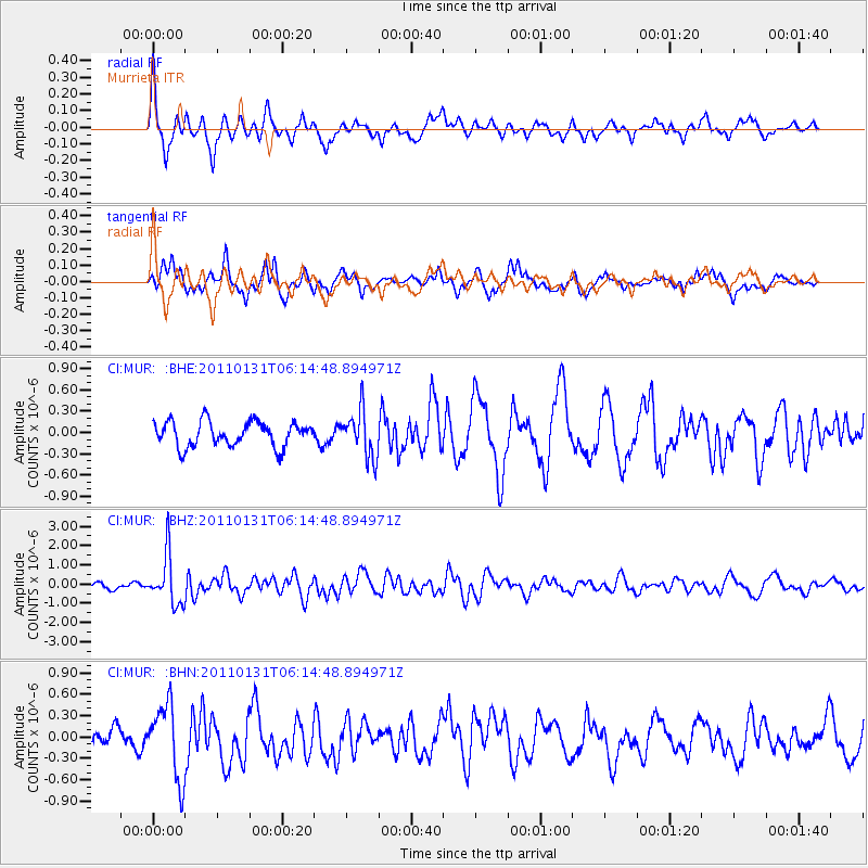
MUR Murrieta - Earthquake Result Viewer
*The percent match for this event was below the threshold and hence no stack was calculated.
| Earthquake location: |
Tonga Islands Region |
| Earthquake latitude/longitude: |
-22.0/-175.6 |
| Earthquake time(UTC): |
2011/01/31 (031) 06:03:27 GMT |
| Earthquake Depth: |
76 km |
| Earthquake Magnitude: |
6.0 MB, 6.0 MW, 6.0 MW |
| Earthquake Catalog/Contributor: |
WHDF/NEIC |
|
| Network: |
CI Caltech Regional Seismic Network |
| Station: |
MUR Murrieta |
| Lat/Lon: |
33.60 N/117.20 W |
| Elevation: |
562 m |
|
| Distance: |
78.4 deg |
| Az: |
46.534 deg |
| Baz: |
233.802 deg |
| Ray Param: |
$rayparam |
*The percent match for this event was below the threshold and hence was not used in the summary stack. |
|
| Radial Match: |
56.022373 % |
| Radial Bump: |
368 |
| Transverse Match: |
55.484875 % |
| Transverse Bump: |
400 |
| SOD ConfigId: |
350818 |
| Insert Time: |
2011-07-20 11:18:42.826 +0000 |
| GWidth: |
2.5 |
| Max Bumps: |
400 |
| Tol: |
0.001 |
|
Signal To Noise
| Channel | StoN | STA | LTA |
| CI:MUR: :BHZ:20110131T06:14:48.894971Z | 8.45498 | 1.2854136E-6 | 1.5203035E-7 |
| CI:MUR: :BHN:20110131T06:14:48.894971Z | 3.8679001 | 5.1647737E-7 | 1.3352914E-7 |
| CI:MUR: :BHE:20110131T06:14:48.894971Z | 1.8767067 | 3.2972233E-7 | 1.7569198E-7 |
| Arrivals |
| Ps | |
| PpPs | |
| PsPs/PpSs | |


