You are here: Home > Network List > IW - Intermountain West Stations List
> Station MOOW Moose Ponds, Wyoming, USA > Earthquake Result Viewer
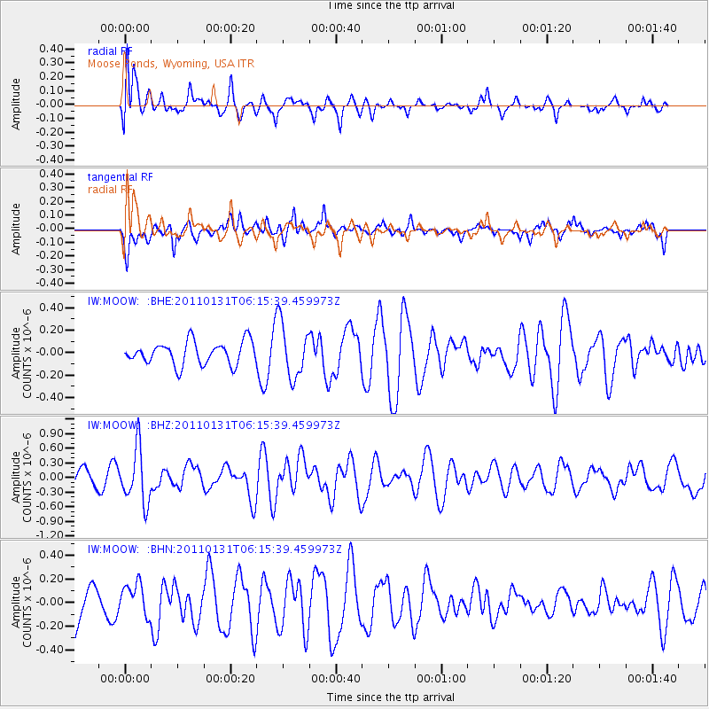
MOOW Moose Ponds, Wyoming, USA - Earthquake Result Viewer
*The percent match for this event was below the threshold and hence no stack was calculated.
| Earthquake location: |
Tonga Islands Region |
| Earthquake latitude/longitude: |
-22.0/-175.6 |
| Earthquake time(UTC): |
2011/01/31 (031) 06:03:27 GMT |
| Earthquake Depth: |
76 km |
| Earthquake Magnitude: |
6.0 MB, 6.0 MW, 6.0 MW |
| Earthquake Catalog/Contributor: |
WHDF/NEIC |
|
| Network: |
IW Intermountain West |
| Station: |
MOOW Moose Ponds, Wyoming, USA |
| Lat/Lon: |
43.75 N/110.74 W |
| Elevation: |
2128 m |
|
| Distance: |
88.4 deg |
| Az: |
41.027 deg |
| Baz: |
237.199 deg |
| Ray Param: |
$rayparam |
*The percent match for this event was below the threshold and hence was not used in the summary stack. |
|
| Radial Match: |
64.83074 % |
| Radial Bump: |
400 |
| Transverse Match: |
61.441933 % |
| Transverse Bump: |
395 |
| SOD ConfigId: |
350818 |
| Insert Time: |
2011-07-20 11:33:16.585 +0000 |
| GWidth: |
2.5 |
| Max Bumps: |
400 |
| Tol: |
0.001 |
|
Signal To Noise
| Channel | StoN | STA | LTA |
| IW:MOOW: :BHZ:20110131T06:15:39.459973Z | 2.1643748 | 5.641378E-7 | 2.60647E-7 |
| IW:MOOW: :BHN:20110131T06:15:39.459973Z | 0.5369537 | 1.367944E-7 | 2.5476015E-7 |
| IW:MOOW: :BHE:20110131T06:15:39.459973Z | 2.327516 | 2.3620942E-7 | 1.01485625E-7 |
| Arrivals |
| Ps | |
| PpPs | |
| PsPs/PpSs | |


