You are here: Home > Network List > IW - Intermountain West Stations List
> Station IMW Indian Meadow, Wyoming, USA > Earthquake Result Viewer
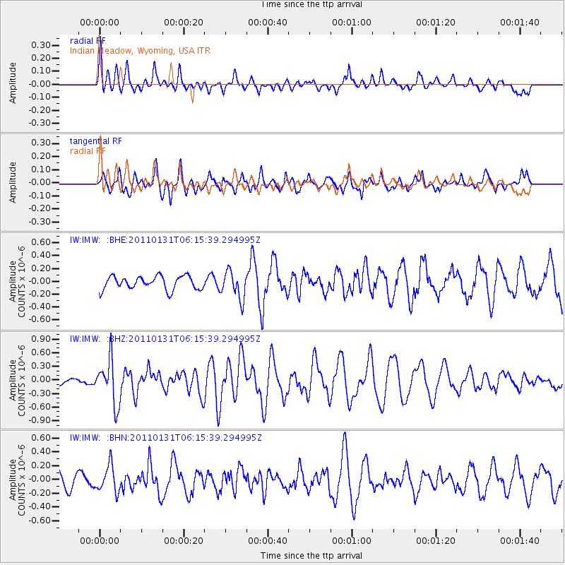
IMW Indian Meadow, Wyoming, USA - Earthquake Result Viewer
*The percent match for this event was below the threshold and hence no stack was calculated.
| Earthquake location: |
Tonga Islands Region |
| Earthquake latitude/longitude: |
-22.0/-175.6 |
| Earthquake time(UTC): |
2011/01/31 (031) 06:03:27 GMT |
| Earthquake Depth: |
76 km |
| Earthquake Magnitude: |
6.0 MB, 6.0 MW, 6.0 MW |
| Earthquake Catalog/Contributor: |
WHDF/NEIC |
|
| Network: |
IW Intermountain West |
| Station: |
IMW Indian Meadow, Wyoming, USA |
| Lat/Lon: |
43.90 N/110.94 W |
| Elevation: |
2646 m |
|
| Distance: |
88.3 deg |
| Az: |
40.826 deg |
| Baz: |
237.059 deg |
| Ray Param: |
$rayparam |
*The percent match for this event was below the threshold and hence was not used in the summary stack. |
|
| Radial Match: |
52.78372 % |
| Radial Bump: |
380 |
| Transverse Match: |
61.384636 % |
| Transverse Bump: |
400 |
| SOD ConfigId: |
350818 |
| Insert Time: |
2011-07-20 11:34:41.617 +0000 |
| GWidth: |
2.5 |
| Max Bumps: |
400 |
| Tol: |
0.001 |
|
Signal To Noise
| Channel | StoN | STA | LTA |
| IW:IMW: :BHZ:20110131T06:15:39.294995Z | 2.4200459 | 5.035399E-7 | 2.080704E-7 |
| IW:IMW: :BHN:20110131T06:15:39.294995Z | 1.5280709 | 1.9685673E-7 | 1.2882695E-7 |
| IW:IMW: :BHE:20110131T06:15:39.294995Z | 2.0969572 | 2.1741567E-7 | 1.036815E-7 |
| Arrivals |
| Ps | |
| PpPs | |
| PsPs/PpSs | |


