You are here: Home > Network List > TA - USArray Transportable Network (new EarthScope stations) Stations List
> Station Y12C Blythe, CA, USA > Earthquake Result Viewer
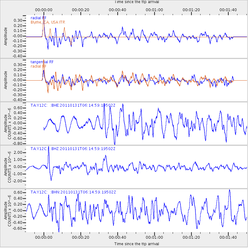
Y12C Blythe, CA, USA - Earthquake Result Viewer
*The percent match for this event was below the threshold and hence no stack was calculated.
| Earthquake location: |
Tonga Islands Region |
| Earthquake latitude/longitude: |
-22.0/-175.6 |
| Earthquake time(UTC): |
2011/01/31 (031) 06:03:27 GMT |
| Earthquake Depth: |
76 km |
| Earthquake Magnitude: |
6.0 MB, 6.0 MW, 6.0 MW |
| Earthquake Catalog/Contributor: |
WHDF/NEIC |
|
| Network: |
TA USArray Transportable Network (new EarthScope stations) |
| Station: |
Y12C Blythe, CA, USA |
| Lat/Lon: |
33.75 N/114.52 W |
| Elevation: |
196 m |
|
| Distance: |
80.3 deg |
| Az: |
47.721 deg |
| Baz: |
235.495 deg |
| Ray Param: |
$rayparam |
*The percent match for this event was below the threshold and hence was not used in the summary stack. |
|
| Radial Match: |
67.08054 % |
| Radial Bump: |
394 |
| Transverse Match: |
68.285126 % |
| Transverse Bump: |
400 |
| SOD ConfigId: |
350818 |
| Insert Time: |
2011-07-20 11:43:26.460 +0000 |
| GWidth: |
2.5 |
| Max Bumps: |
400 |
| Tol: |
0.001 |
|
Signal To Noise
| Channel | StoN | STA | LTA |
| TA:Y12C: :BHZ:20110131T06:14:59.19502Z | 4.647063 | 1.0629602E-6 | 2.2873809E-7 |
| TA:Y12C: :BHN:20110131T06:14:59.19502Z | 0.8178824 | 1.9075944E-7 | 2.3323578E-7 |
| TA:Y12C: :BHE:20110131T06:14:59.19502Z | 1.9110882 | 3.4124233E-7 | 1.7855918E-7 |
| Arrivals |
| Ps | |
| PpPs | |
| PsPs/PpSs | |


