You are here: Home > Network List > TA - USArray Transportable Network (new EarthScope stations) Stations List
> Station MDND Maddock, ND, USA > Earthquake Result Viewer
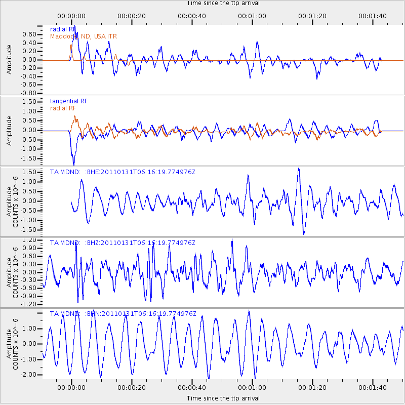
MDND Maddock, ND, USA - Earthquake Result Viewer
*The percent match for this event was below the threshold and hence no stack was calculated.
| Earthquake location: |
Tonga Islands Region |
| Earthquake latitude/longitude: |
-22.0/-175.6 |
| Earthquake time(UTC): |
2011/01/31 (031) 06:03:27 GMT |
| Earthquake Depth: |
76 km |
| Earthquake Magnitude: |
6.0 MB, 6.0 MW, 6.0 MW |
| Earthquake Catalog/Contributor: |
WHDF/NEIC |
|
| Network: |
TA USArray Transportable Network (new EarthScope stations) |
| Station: |
MDND Maddock, ND, USA |
| Lat/Lon: |
47.85 N/99.60 W |
| Elevation: |
479 m |
|
| Distance: |
97.1 deg |
| Az: |
41.203 deg |
| Baz: |
245.169 deg |
| Ray Param: |
$rayparam |
*The percent match for this event was below the threshold and hence was not used in the summary stack. |
|
| Radial Match: |
68.000496 % |
| Radial Bump: |
400 |
| Transverse Match: |
60.72819 % |
| Transverse Bump: |
400 |
| SOD ConfigId: |
350818 |
| Insert Time: |
2011-07-20 11:51:01.773 +0000 |
| GWidth: |
2.5 |
| Max Bumps: |
400 |
| Tol: |
0.001 |
|
Signal To Noise
| Channel | StoN | STA | LTA |
| TA:MDND: :BHZ:20110131T06:16:19.774976Z | 2.0633395 | 5.2096044E-7 | 2.524841E-7 |
| TA:MDND: :BHN:20110131T06:16:19.774976Z | 2.7587519 | 1.518599E-6 | 5.50466E-7 |
| TA:MDND: :BHE:20110131T06:16:19.774976Z | 0.31214413 | 1.5309513E-7 | 4.904629E-7 |
| Arrivals |
| Ps | |
| PpPs | |
| PsPs/PpSs | |


