You are here: Home > Network List > TA - USArray Transportable Network (new EarthScope stations) Stations List
> Station X30A Coker Ranch, Turkey, TX, USA > Earthquake Result Viewer
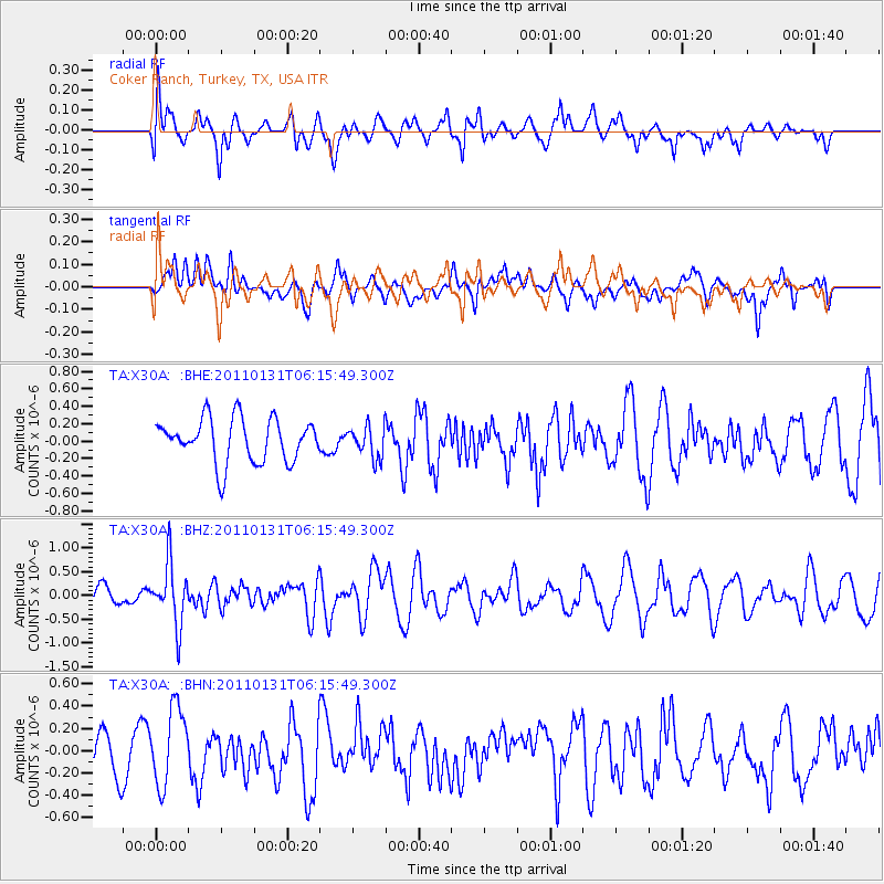
X30A Coker Ranch, Turkey, TX, USA - Earthquake Result Viewer
*The percent match for this event was below the threshold and hence no stack was calculated.
| Earthquake location: |
Tonga Islands Region |
| Earthquake latitude/longitude: |
-22.0/-175.6 |
| Earthquake time(UTC): |
2011/01/31 (031) 06:03:27 GMT |
| Earthquake Depth: |
76 km |
| Earthquake Magnitude: |
6.0 MB, 6.0 MW, 6.0 MW |
| Earthquake Catalog/Contributor: |
WHDF/NEIC |
|
| Network: |
TA USArray Transportable Network (new EarthScope stations) |
| Station: |
X30A Coker Ranch, Turkey, TX, USA |
| Lat/Lon: |
34.45 N/100.87 W |
| Elevation: |
698 m |
|
| Distance: |
90.5 deg |
| Az: |
52.877 deg |
| Baz: |
243.552 deg |
| Ray Param: |
$rayparam |
*The percent match for this event was below the threshold and hence was not used in the summary stack. |
|
| Radial Match: |
74.84248 % |
| Radial Bump: |
400 |
| Transverse Match: |
46.103046 % |
| Transverse Bump: |
400 |
| SOD ConfigId: |
350818 |
| Insert Time: |
2011-07-20 11:56:42.025 +0000 |
| GWidth: |
2.5 |
| Max Bumps: |
400 |
| Tol: |
0.001 |
|
Signal To Noise
| Channel | StoN | STA | LTA |
| TA:X30A: :BHZ:20110131T06:15:49.300Z | 2.6816819 | 6.3591386E-7 | 2.3713247E-7 |
| TA:X30A: :BHN:20110131T06:15:49.300Z | 1.5924647 | 3.4347116E-7 | 2.1568526E-7 |
| TA:X30A: :BHE:20110131T06:15:49.300Z | 0.7285893 | 1.8107258E-7 | 2.4852488E-7 |
| Arrivals |
| Ps | |
| PpPs | |
| PsPs/PpSs | |


