You are here: Home > Network List > TA - USArray Transportable Network (new EarthScope stations) Stations List
> Station Q29A Oakley, KS, USA > Earthquake Result Viewer
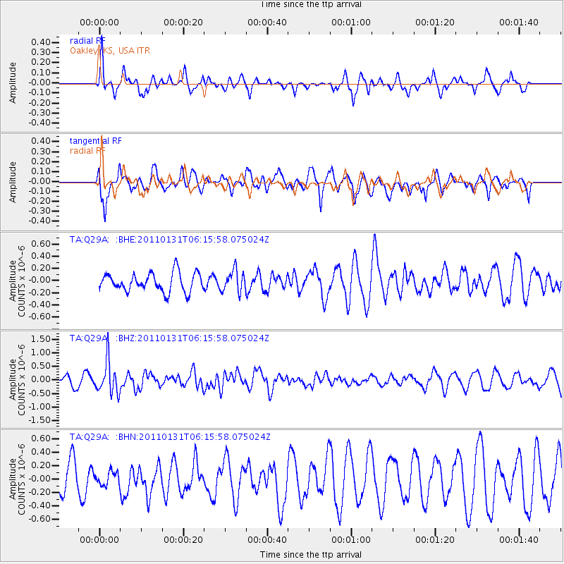
Q29A Oakley, KS, USA - Earthquake Result Viewer
*The percent match for this event was below the threshold and hence no stack was calculated.
| Earthquake location: |
Tonga Islands Region |
| Earthquake latitude/longitude: |
-22.0/-175.6 |
| Earthquake time(UTC): |
2011/01/31 (031) 06:03:27 GMT |
| Earthquake Depth: |
76 km |
| Earthquake Magnitude: |
6.0 MB, 6.0 MW, 6.0 MW |
| Earthquake Catalog/Contributor: |
WHDF/NEIC |
|
| Network: |
TA USArray Transportable Network (new EarthScope stations) |
| Station: |
Q29A Oakley, KS, USA |
| Lat/Lon: |
38.89 N/100.98 W |
| Elevation: |
895 m |
|
| Distance: |
92.4 deg |
| Az: |
48.866 deg |
| Baz: |
243.588 deg |
| Ray Param: |
$rayparam |
*The percent match for this event was below the threshold and hence was not used in the summary stack. |
|
| Radial Match: |
59.35762 % |
| Radial Bump: |
369 |
| Transverse Match: |
58.708107 % |
| Transverse Bump: |
400 |
| SOD ConfigId: |
350818 |
| Insert Time: |
2011-07-20 12:06:00.124 +0000 |
| GWidth: |
2.5 |
| Max Bumps: |
400 |
| Tol: |
0.001 |
|
Signal To Noise
| Channel | StoN | STA | LTA |
| TA:Q29A: :BHZ:20110131T06:15:58.075024Z | 2.5034943 | 6.046262E-7 | 2.415129E-7 |
| TA:Q29A: :BHN:20110131T06:15:58.075024Z | 0.3425968 | 9.941086E-8 | 2.9016869E-7 |
| TA:Q29A: :BHE:20110131T06:15:58.075024Z | 1.1533858 | 1.765196E-7 | 1.5304474E-7 |
| Arrivals |
| Ps | |
| PpPs | |
| PsPs/PpSs | |


