You are here: Home > Network List > TA - USArray Transportable Network (new EarthScope stations) Stations List
> Station H28A Mission Ridge, SD, USA > Earthquake Result Viewer
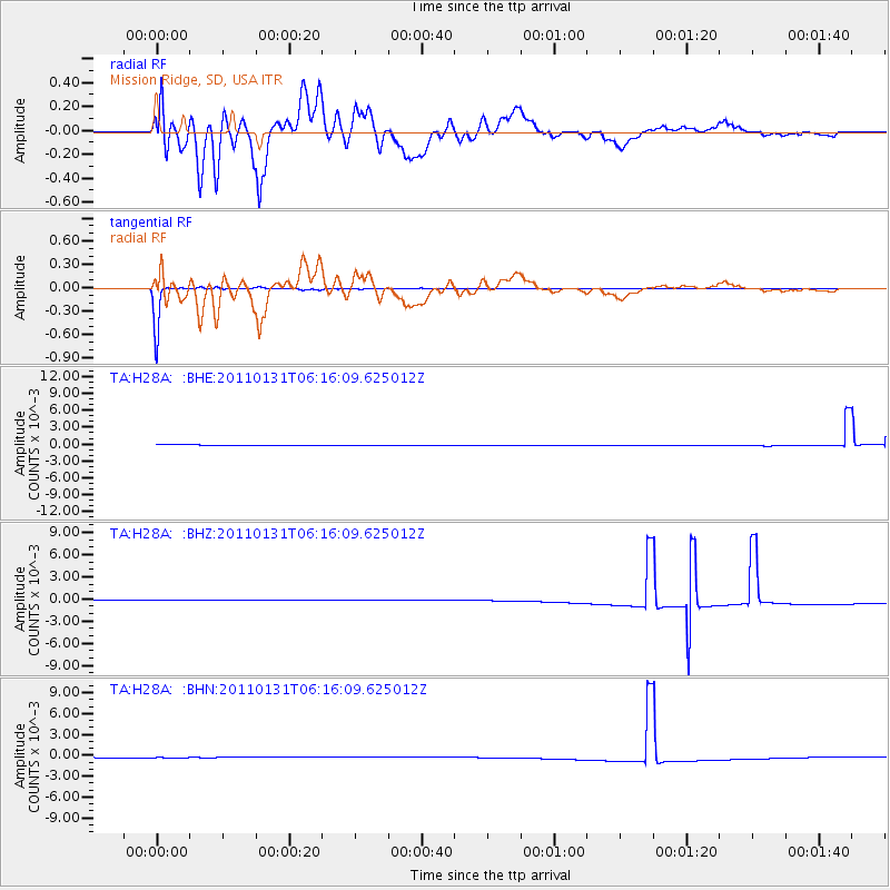
H28A Mission Ridge, SD, USA - Earthquake Result Viewer
*The percent match for this event was below the threshold and hence no stack was calculated.
| Earthquake location: |
Tonga Islands Region |
| Earthquake latitude/longitude: |
-22.0/-175.6 |
| Earthquake time(UTC): |
2011/01/31 (031) 06:03:27 GMT |
| Earthquake Depth: |
76 km |
| Earthquake Magnitude: |
6.0 MB, 6.0 MW, 6.0 MW |
| Earthquake Catalog/Contributor: |
WHDF/NEIC |
|
| Network: |
TA USArray Transportable Network (new EarthScope stations) |
| Station: |
H28A Mission Ridge, SD, USA |
| Lat/Lon: |
44.68 N/101.02 W |
| Elevation: |
642 m |
|
| Distance: |
94.9 deg |
| Az: |
43.659 deg |
| Baz: |
243.89 deg |
| Ray Param: |
$rayparam |
*The percent match for this event was below the threshold and hence was not used in the summary stack. |
|
| Radial Match: |
42.089775 % |
| Radial Bump: |
400 |
| Transverse Match: |
99.17529 % |
| Transverse Bump: |
54 |
| SOD ConfigId: |
350818 |
| Insert Time: |
2011-07-20 12:13:24.477 +0000 |
| GWidth: |
2.5 |
| Max Bumps: |
400 |
| Tol: |
0.001 |
|
Signal To Noise
| Channel | StoN | STA | LTA |
| TA:H28A: :BHZ:20110131T06:16:09.625012Z | 0.90343523 | 5.305393E-5 | 5.872466E-5 |
| TA:H28A: :BHN:20110131T06:16:09.625012Z | 0.9444274 | 1.0719574E-5 | 1.1350342E-5 |
| TA:H28A: :BHE:20110131T06:16:09.625012Z | 0.9121934 | 8.309798E-5 | 9.109688E-5 |
| Arrivals |
| Ps | |
| PpPs | |
| PsPs/PpSs | |


