You are here: Home > Network List > TA - USArray Transportable Network (new EarthScope stations) Stations List
> Station E29A Napoleon, ND, USA > Earthquake Result Viewer
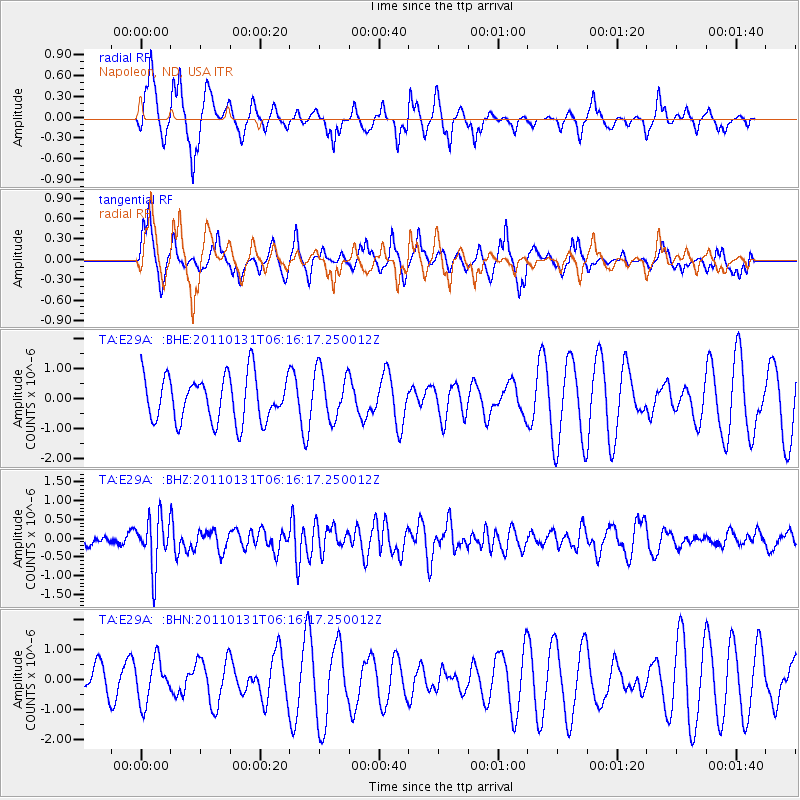
E29A Napoleon, ND, USA - Earthquake Result Viewer
*The percent match for this event was below the threshold and hence no stack was calculated.
| Earthquake location: |
Tonga Islands Region |
| Earthquake latitude/longitude: |
-22.0/-175.6 |
| Earthquake time(UTC): |
2011/01/31 (031) 06:03:27 GMT |
| Earthquake Depth: |
76 km |
| Earthquake Magnitude: |
6.0 MB, 6.0 MW, 6.0 MW |
| Earthquake Catalog/Contributor: |
WHDF/NEIC |
|
| Network: |
TA USArray Transportable Network (new EarthScope stations) |
| Station: |
E29A Napoleon, ND, USA |
| Lat/Lon: |
46.57 N/99.64 W |
| Elevation: |
628 m |
|
| Distance: |
96.6 deg |
| Az: |
42.362 deg |
| Baz: |
245.002 deg |
| Ray Param: |
$rayparam |
*The percent match for this event was below the threshold and hence was not used in the summary stack. |
|
| Radial Match: |
54.60451 % |
| Radial Bump: |
298 |
| Transverse Match: |
49.389946 % |
| Transverse Bump: |
328 |
| SOD ConfigId: |
350818 |
| Insert Time: |
2011-07-20 12:21:48.930 +0000 |
| GWidth: |
2.5 |
| Max Bumps: |
400 |
| Tol: |
0.001 |
|
Signal To Noise
| Channel | StoN | STA | LTA |
| TA:E29A: :BHZ:20110131T06:16:17.250012Z | 2.7873473 | 6.6917E-7 | 2.4007412E-7 |
| TA:E29A: :BHN:20110131T06:16:17.250012Z | 1.0567175 | 7.010382E-7 | 6.634112E-7 |
| TA:E29A: :BHE:20110131T06:16:17.250012Z | 1.0879773 | 8.247197E-7 | 7.5803024E-7 |
| Arrivals |
| Ps | |
| PpPs | |
| PsPs/PpSs | |


