THUR THUR - Earthquake Result Viewer
Earthquake location: North Island, New Zealand
Earthquake latitude/longitude: -40.7/175.8
Earthquake time(UTC): 2014/01/20 (020) 02:52:44 GMT
Earthquake Depth: 28 km
Earthquake Magnitude: 6.1 MWW, 6.2 MWB, 6.3 MWC
Earthquake Catalog/Contributor: NEIC PDE/NEIC COMCAT
Network: YT POLENET
Station: THUR THUR
Lat/Lon: 72.53 S/97.56 W
Elevation: 239 m
Distance: 50.8 deg
Az: 157.097 deg
Baz: 258.584 deg
Ray Param: 0.06777656
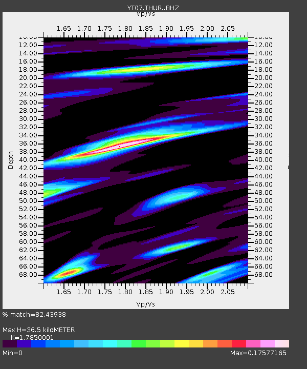
Estimated Moho Depth: 36.5 km
Estimated Crust Vp/Vs: 1.79
Assumed Crust Vp: 6.43 km/s
Estimated Crust Vs: 3.602 km/s
Estimated Crust Poisson's Ratio: 0.27
Radial Match: 82.43938 %
Radial Bump: 400
Transverse Match: 83.23863 %
Transverse Bump: 400
SOD ConfigId: 3390531
Insert Time: 2019-04-10 01:30:52.207 +0000
GWidth: 2.5
Max Bumps: 400
Tol: 0.001

Signal To Noise

ChannelStoNSTALTA
YT:THUR: :BHZ:20140120T03:01:12.175012Z8.5637591.4953516E-61.7461392E-7
YT:THUR: :BHN:20140120T03:01:12.175012Z1.14847932.7669105E-72.4091946E-7
YT:THUR: :BHE:20140120T03:01:12.175012Z0.78816868.192556E-91.039442E-8
Arrivals
Ps4.7 SECOND
PpPs15 SECOND
PsPs/PpSs20 SECOND