You are here: Home > Network List > CI - Caltech Regional Seismic Network Stations List
> Station FUR Furnace Creek, CA, USA > Earthquake Result Viewer
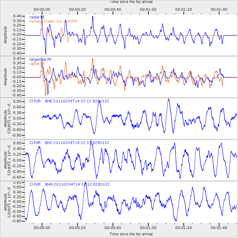
FUR Furnace Creek, CA, USA - Earthquake Result Viewer
*The percent match for this event was below the threshold and hence no stack was calculated.
| Earthquake location: |
Vanuatu Islands |
| Earthquake latitude/longitude: |
-14.2/166.5 |
| Earthquake time(UTC): |
2011/02/04 (035) 14:20:55 GMT |
| Earthquake Depth: |
10 km |
| Earthquake Magnitude: |
5.8 MB, 5.9 MW |
| Earthquake Catalog/Contributor: |
WHDF/NEIC |
|
| Network: |
CI Caltech Regional Seismic Network |
| Station: |
FUR Furnace Creek, CA, USA |
| Lat/Lon: |
36.47 N/116.86 W |
| Elevation: |
-37.0 m |
|
| Distance: |
87.9 deg |
| Az: |
51.713 deg |
| Baz: |
250.804 deg |
| Ray Param: |
$rayparam |
*The percent match for this event was below the threshold and hence was not used in the summary stack. |
|
| Radial Match: |
64.934814 % |
| Radial Bump: |
400 |
| Transverse Match: |
52.1112 % |
| Transverse Bump: |
400 |
| SOD ConfigId: |
350818 |
| Insert Time: |
2011-07-20 13:05:23.338 +0000 |
| GWidth: |
2.5 |
| Max Bumps: |
400 |
| Tol: |
0.001 |
|
Signal To Noise
| Channel | StoN | STA | LTA |
| CI:FUR: :BHZ:20110204T14:33:13.828013Z | 0.5082052 | 1.4337469E-7 | 2.8211971E-7 |
| CI:FUR: :BHN:20110204T14:33:13.828013Z | 0.78414166 | 3.1678715E-7 | 4.0399223E-7 |
| CI:FUR: :BHE:20110204T14:33:13.828013Z | 2.5119154 | 5.941213E-7 | 2.365212E-7 |
| Arrivals |
| Ps | |
| PpPs | |
| PsPs/PpSs | |


