You are here: Home > Network List > KN - Kyrgyz Seismic Telemetry Network Stations List
> Station KZA KN.KZA > Earthquake Result Viewer
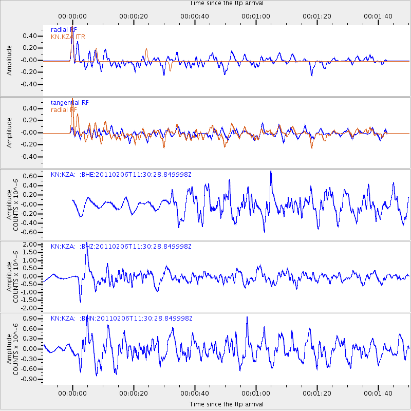
KZA KN.KZA - Earthquake Result Viewer
*The percent match for this event was below the threshold and hence no stack was calculated.
| Earthquake location: |
Southwest Of Sumatra, Indonesia |
| Earthquake latitude/longitude: |
-8.3/104.1 |
| Earthquake time(UTC): |
2011/02/06 (037) 11:21:17 GMT |
| Earthquake Depth: |
13 km |
| Earthquake Magnitude: |
5.6 MB, 5.2 MS, 5.7 MW, 5.6 MW |
| Earthquake Catalog/Contributor: |
WHDF/NEIC |
|
| Network: |
KN Kyrgyz Seismic Telemetry Network |
| Station: |
KZA KN.KZA |
| Lat/Lon: |
42.08 N/75.25 E |
| Elevation: |
3520 m |
|
| Distance: |
56.6 deg |
| Az: |
334.545 deg |
| Baz: |
145.153 deg |
| Ray Param: |
$rayparam |
*The percent match for this event was below the threshold and hence was not used in the summary stack. |
|
| Radial Match: |
70.42299 % |
| Radial Bump: |
400 |
| Transverse Match: |
68.35951 % |
| Transverse Bump: |
400 |
| SOD ConfigId: |
350818 |
| Insert Time: |
2011-07-22 06:54:22.356 +0000 |
| GWidth: |
2.5 |
| Max Bumps: |
400 |
| Tol: |
0.001 |
|
Signal To Noise
| Channel | StoN | STA | LTA |
| KN:KZA: :BHZ:20110206T11:30:28.849998Z | 6.2108946 | 7.799125E-7 | 1.2557167E-7 |
| KN:KZA: :BHN:20110206T11:30:28.849998Z | 2.5432177 | 3.520921E-7 | 1.3844355E-7 |
| KN:KZA: :BHE:20110206T11:30:28.849998Z | 1.7503948 | 1.6893375E-7 | 9.65118E-8 |
| Arrivals |
| Ps | |
| PpPs | |
| PsPs/PpSs | |


