You are here: Home > Network List > KN - Kyrgyz Seismic Telemetry Network Stations List
> Station TKM2 - > Earthquake Result Viewer
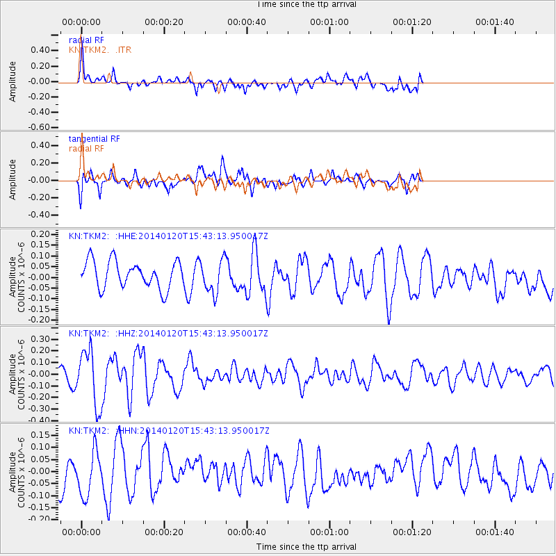
TKM2 - - Earthquake Result Viewer
*The percent match for this event was below the threshold and hence no stack was calculated.
| Earthquake location: |
W. Caroline Islands, Micronesia |
| Earthquake latitude/longitude: |
9.0/138.2 |
| Earthquake time(UTC): |
2014/01/20 (020) 15:33:14 GMT |
| Earthquake Depth: |
29 km |
| Earthquake Magnitude: |
5.3 MW |
| Earthquake Catalog/Contributor: |
ISC/ISC |
|
| Network: |
KN Kyrgyz Seismic Telemetry Network |
| Station: |
TKM2 - |
| Lat/Lon: |
42.92 N/75.60 E |
| Elevation: |
2020 m |
|
| Distance: |
64.0 deg |
| Az: |
313.451 deg |
| Baz: |
102.492 deg |
| Ray Param: |
$rayparam |
*The percent match for this event was below the threshold and hence was not used in the summary stack. |
|
| Radial Match: |
58.81067 % |
| Radial Bump: |
400 |
| Transverse Match: |
59.477192 % |
| Transverse Bump: |
400 |
| SOD ConfigId: |
3390531 |
| Insert Time: |
2019-04-10 01:33:09.016 +0000 |
| GWidth: |
2.5 |
| Max Bumps: |
400 |
| Tol: |
0.001 |
|
Signal To Noise
| Channel | StoN | STA | LTA |
| KN:TKM2: :HHZ:20140120T15:43:13.950017Z | 3.1479518 | 2.4151842E-7 | 7.67224E-8 |
| KN:TKM2: :HHN:20140120T15:43:13.950017Z | 1.9332522 | 9.467501E-8 | 4.8971888E-8 |
| KN:TKM2: :HHE:20140120T15:43:13.950017Z | 1.2521342 | 7.886822E-8 | 6.298703E-8 |
| Arrivals |
| Ps | |
| PpPs | |
| PsPs/PpSs | |


