HWB AZ.HWB - Earthquake Result Viewer
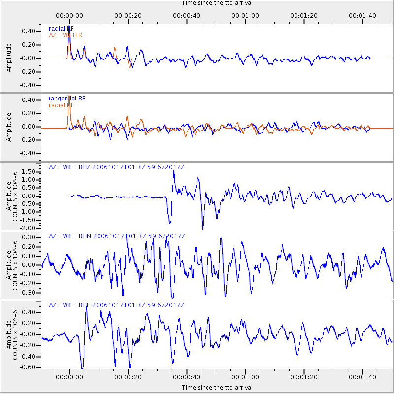
Earthquake location: New Britain Region, P.N.G.
Earthquake latitude/longitude: -5.9/151.0
Earthquake time(UTC): 2006/10/17 (290) 01:25:12 GMT
Earthquake Depth: 32 km
Earthquake Magnitude: 6.4 MB, 6.9 MS, 6.7 MW, 6.6 MW
Earthquake Catalog/Contributor: WHDF/NEIC
Network: AZ ANZA Regional Network
Station: HWB AZ.HWB
Lat/Lon: 33.03 N/116.96 W
Elevation: 478 m
Distance: 94.9 deg
Az: 57.417 deg
Baz: 266.195 deg
Ray Param: 0.040914226
Estimated Moho Depth: 33.25 km
Estimated Crust Vp/Vs: 1.60
Assumed Crust Vp: 6.264 km/s
Estimated Crust Vs: 3.915 km/s
Estimated Crust Poisson's Ratio: 0.18
Radial Match: 92.237015 %
Radial Bump: 400
Transverse Match: 77.389275 %
Transverse Bump: 400
SOD ConfigId: 2665
Insert Time: 2010-02-26 19:26:31.172 +0000
GWidth: 2.5
Max Bumps: 400
Tol: 0.001

Signal To Noise

ChannelStoNSTALTA
AZ:HWB: :BHN:20061017T01:37:59.672017Z1.57182261.0070478E-76.40688E-8
AZ:HWB: :BHE:20061017T01:37:59.672017Z3.93417452.781489E-77.070069E-8
AZ:HWB: :BHZ:20061017T01:37:59.672017Z11.8075736.7793223E-75.7415033E-8
Arrivals
Ps3.3 SECOND
PpPs14 SECOND
PsPs/PpSs17 SECOND