You are here: Home > Network List > AK - Alaska Regional Network Stations List
> Station MDM Murphy Dome > Earthquake Result Viewer
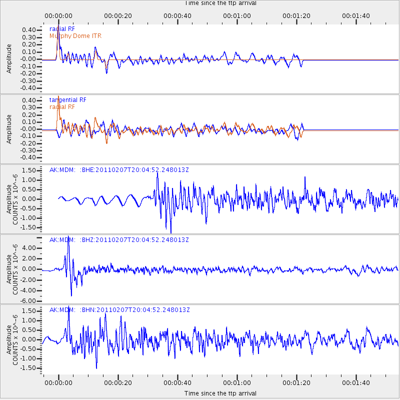
MDM Murphy Dome - Earthquake Result Viewer
*The percent match for this event was below the threshold and hence no stack was calculated.
| Earthquake location: |
Solomon Islands |
| Earthquake latitude/longitude: |
-7.2/155.2 |
| Earthquake time(UTC): |
2011/02/07 (038) 19:53:44 GMT |
| Earthquake Depth: |
429 km |
| Earthquake Magnitude: |
5.9 MB, 6.4 MW, 6.4 MW |
| Earthquake Catalog/Contributor: |
WHDF/NEIC |
|
| Network: |
AK Alaska Regional Network |
| Station: |
MDM Murphy Dome |
| Lat/Lon: |
64.96 N/148.23 W |
| Elevation: |
634 m |
|
| Distance: |
83.1 deg |
| Az: |
20.972 deg |
| Baz: |
236.559 deg |
| Ray Param: |
$rayparam |
*The percent match for this event was below the threshold and hence was not used in the summary stack. |
|
| Radial Match: |
78.47303 % |
| Radial Bump: |
400 |
| Transverse Match: |
67.20373 % |
| Transverse Bump: |
375 |
| SOD ConfigId: |
350818 |
| Insert Time: |
2011-07-22 07:01:55.839 +0000 |
| GWidth: |
2.5 |
| Max Bumps: |
400 |
| Tol: |
0.001 |
|
Signal To Noise
| Channel | StoN | STA | LTA |
| AK:MDM: :BHZ:20110207T20:04:52.248013Z | 10.819624 | 2.1910025E-6 | 2.0250263E-7 |
| AK:MDM: :BHN:20110207T20:04:52.248013Z | 3.684717 | 5.260693E-7 | 1.4277062E-7 |
| AK:MDM: :BHE:20110207T20:04:52.248013Z | 3.2186053 | 4.6520594E-7 | 1.445365E-7 |
| Arrivals |
| Ps | |
| PpPs | |
| PsPs/PpSs | |


