You are here: Home > Network List > AZ - ANZA Regional Network Stations List
> Station SMER AZ.SMER > Earthquake Result Viewer
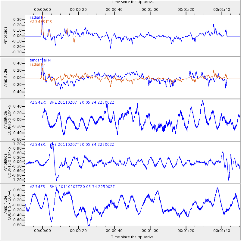
SMER AZ.SMER - Earthquake Result Viewer
*The percent match for this event was below the threshold and hence no stack was calculated.
| Earthquake location: |
Solomon Islands |
| Earthquake latitude/longitude: |
-7.2/155.2 |
| Earthquake time(UTC): |
2011/02/07 (038) 19:53:44 GMT |
| Earthquake Depth: |
429 km |
| Earthquake Magnitude: |
5.9 MB, 6.4 MW, 6.4 MW |
| Earthquake Catalog/Contributor: |
WHDF/NEIC |
|
| Network: |
AZ ANZA Regional Network |
| Station: |
SMER AZ.SMER |
| Lat/Lon: |
33.46 N/117.17 W |
| Elevation: |
355 m |
|
| Distance: |
91.9 deg |
| Az: |
56.696 deg |
| Baz: |
262.768 deg |
| Ray Param: |
$rayparam |
*The percent match for this event was below the threshold and hence was not used in the summary stack. |
|
| Radial Match: |
51.555386 % |
| Radial Bump: |
400 |
| Transverse Match: |
53.825893 % |
| Transverse Bump: |
400 |
| SOD ConfigId: |
350818 |
| Insert Time: |
2011-07-22 07:05:48.585 +0000 |
| GWidth: |
2.5 |
| Max Bumps: |
400 |
| Tol: |
0.001 |
|
Signal To Noise
| Channel | StoN | STA | LTA |
| AZ:SMER: :BHZ:20110207T20:05:34.225002Z | 2.60598 | 4.3635643E-7 | 1.6744428E-7 |
| AZ:SMER: :BHN:20110207T20:05:34.225002Z | 1.0748979 | 3.837501E-7 | 3.5701075E-7 |
| AZ:SMER: :BHE:20110207T20:05:34.225002Z | 0.77428997 | 1.3225264E-7 | 1.7080505E-7 |
| Arrivals |
| Ps | |
| PpPs | |
| PsPs/PpSs | |


