You are here: Home > Network List > CI - Caltech Regional Seismic Network Stations List
> Station BAR Barrett, Tecate, CA, USA > Earthquake Result Viewer
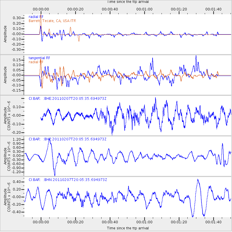
BAR Barrett, Tecate, CA, USA - Earthquake Result Viewer
*The percent match for this event was below the threshold and hence no stack was calculated.
| Earthquake location: |
Solomon Islands |
| Earthquake latitude/longitude: |
-7.2/155.2 |
| Earthquake time(UTC): |
2011/02/07 (038) 19:53:44 GMT |
| Earthquake Depth: |
429 km |
| Earthquake Magnitude: |
5.9 MB, 6.4 MW, 6.4 MW |
| Earthquake Catalog/Contributor: |
WHDF/NEIC |
|
| Network: |
CI Caltech Regional Seismic Network |
| Station: |
BAR Barrett, Tecate, CA, USA |
| Lat/Lon: |
32.68 N/116.67 W |
| Elevation: |
521 m |
|
| Distance: |
92.3 deg |
| Az: |
57.518 deg |
| Baz: |
263.009 deg |
| Ray Param: |
$rayparam |
*The percent match for this event was below the threshold and hence was not used in the summary stack. |
|
| Radial Match: |
70.67923 % |
| Radial Bump: |
400 |
| Transverse Match: |
70.852264 % |
| Transverse Bump: |
400 |
| SOD ConfigId: |
350818 |
| Insert Time: |
2011-07-22 07:06:55.139 +0000 |
| GWidth: |
2.5 |
| Max Bumps: |
400 |
| Tol: |
0.001 |
|
Signal To Noise
| Channel | StoN | STA | LTA |
| CI:BAR: :BHZ:20110207T20:05:35.694973Z | 3.7778292 | 5.0926445E-7 | 1.3480346E-7 |
| CI:BAR: :BHN:20110207T20:05:35.694973Z | 1.526077 | 1.826211E-7 | 1.1966702E-7 |
| CI:BAR: :BHE:20110207T20:05:35.694973Z | 1.0062994 | 4.0032837E-8 | 3.9782236E-8 |
| Arrivals |
| Ps | |
| PpPs | |
| PsPs/PpSs | |


