You are here: Home > Network List > CI - Caltech Regional Seismic Network Stations List
> Station MPM Manuel Prospect Mine, California, USA > Earthquake Result Viewer
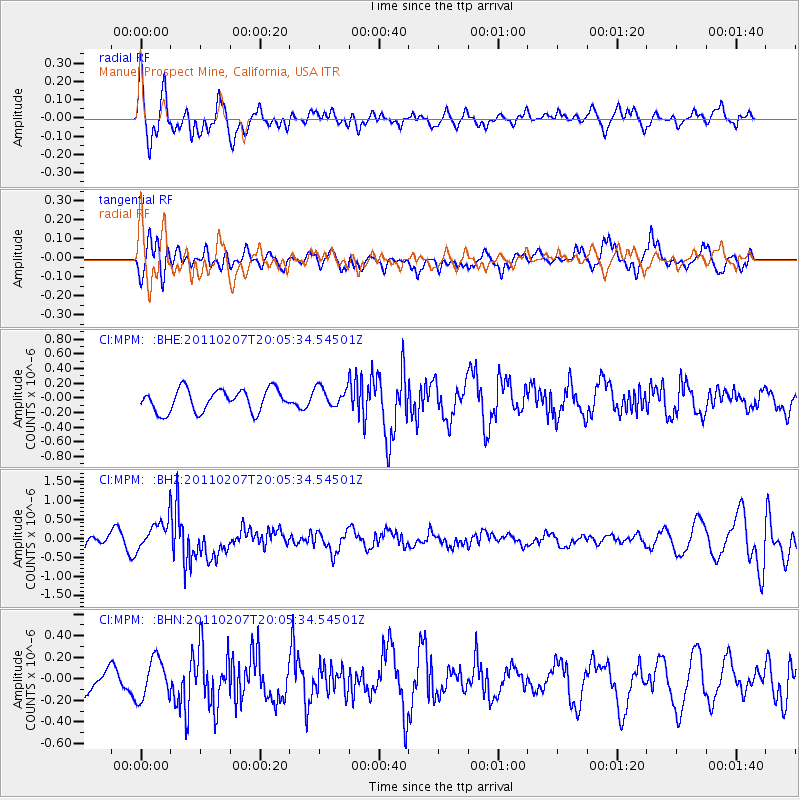
MPM Manuel Prospect Mine, California, USA - Earthquake Result Viewer
*The percent match for this event was below the threshold and hence no stack was calculated.
| Earthquake location: |
Solomon Islands |
| Earthquake latitude/longitude: |
-7.2/155.2 |
| Earthquake time(UTC): |
2011/02/07 (038) 19:53:44 GMT |
| Earthquake Depth: |
429 km |
| Earthquake Magnitude: |
5.9 MB, 6.4 MW, 6.4 MW |
| Earthquake Catalog/Contributor: |
WHDF/NEIC |
|
| Network: |
CI Caltech Regional Seismic Network |
| Station: |
MPM Manuel Prospect Mine, California, USA |
| Lat/Lon: |
36.06 N/117.49 W |
| Elevation: |
185 m |
|
| Distance: |
92.0 deg |
| Az: |
54.088 deg |
| Baz: |
262.678 deg |
| Ray Param: |
$rayparam |
*The percent match for this event was below the threshold and hence was not used in the summary stack. |
|
| Radial Match: |
54.108444 % |
| Radial Bump: |
400 |
| Transverse Match: |
55.535797 % |
| Transverse Bump: |
400 |
| SOD ConfigId: |
350818 |
| Insert Time: |
2011-07-22 07:09:05.087 +0000 |
| GWidth: |
2.5 |
| Max Bumps: |
400 |
| Tol: |
0.001 |
|
Signal To Noise
| Channel | StoN | STA | LTA |
| CI:MPM: :BHZ:20110207T20:05:34.54501Z | 1.9384335 | 3.9765465E-7 | 2.0514226E-7 |
| CI:MPM: :BHN:20110207T20:05:34.54501Z | 0.8615344 | 1.8464411E-7 | 2.1432007E-7 |
| CI:MPM: :BHE:20110207T20:05:34.54501Z | 0.92680466 | 1.3987164E-7 | 1.5091815E-7 |
| Arrivals |
| Ps | |
| PpPs | |
| PsPs/PpSs | |


