You are here: Home > Network List > CI - Caltech Regional Seismic Network Stations List
> Station MPP McPhearson Peak > Earthquake Result Viewer
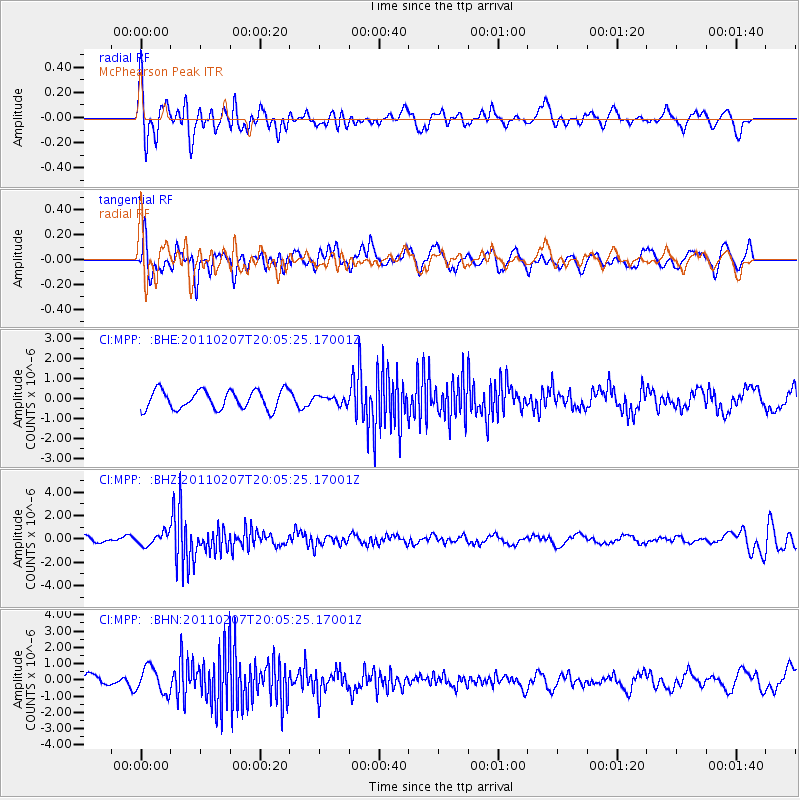
MPP McPhearson Peak - Earthquake Result Viewer
*The percent match for this event was below the threshold and hence no stack was calculated.
| Earthquake location: |
Solomon Islands |
| Earthquake latitude/longitude: |
-7.2/155.2 |
| Earthquake time(UTC): |
2011/02/07 (038) 19:53:44 GMT |
| Earthquake Depth: |
429 km |
| Earthquake Magnitude: |
5.9 MB, 6.4 MW, 6.4 MW |
| Earthquake Catalog/Contributor: |
WHDF/NEIC |
|
| Network: |
CI Caltech Regional Seismic Network |
| Station: |
MPP McPhearson Peak |
| Lat/Lon: |
34.89 N/119.81 W |
| Elevation: |
1739 m |
|
| Distance: |
90.0 deg |
| Az: |
54.98 deg |
| Baz: |
261.319 deg |
| Ray Param: |
$rayparam |
*The percent match for this event was below the threshold and hence was not used in the summary stack. |
|
| Radial Match: |
63.519817 % |
| Radial Bump: |
400 |
| Transverse Match: |
50.86692 % |
| Transverse Bump: |
400 |
| SOD ConfigId: |
350818 |
| Insert Time: |
2011-07-22 07:11:28.235 +0000 |
| GWidth: |
2.5 |
| Max Bumps: |
400 |
| Tol: |
0.001 |
|
Signal To Noise
| Channel | StoN | STA | LTA |
| CI:MPP: :BHZ:20110207T20:05:25.17001Z | 1.4867998 | 5.236171E-7 | 3.5217727E-7 |
| CI:MPP: :BHN:20110207T20:05:25.17001Z | 1.3994936 | 8.016951E-7 | 5.7284655E-7 |
| CI:MPP: :BHE:20110207T20:05:25.17001Z | 0.41885635 | 1.9819863E-7 | 4.7319E-7 |
| Arrivals |
| Ps | |
| PpPs | |
| PsPs/PpSs | |


