You are here: Home > Network List > UW - Pacific Northwest Regional Seismic Network Stations List
> Station LEBA Lebam, WA, USA > Earthquake Result Viewer
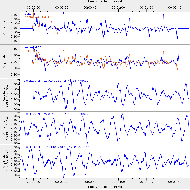
LEBA Lebam, WA, USA - Earthquake Result Viewer
*The percent match for this event was below the threshold and hence no stack was calculated.
| Earthquake location: |
W. Caroline Islands, Micronesia |
| Earthquake latitude/longitude: |
9.0/138.2 |
| Earthquake time(UTC): |
2014/01/20 (020) 15:33:14 GMT |
| Earthquake Depth: |
29 km |
| Earthquake Magnitude: |
5.3 MW |
| Earthquake Catalog/Contributor: |
ISC/ISC |
|
| Network: |
UW Pacific Northwest Regional Seismic Network |
| Station: |
LEBA Lebam, WA, USA |
| Lat/Lon: |
46.55 N/123.56 W |
| Elevation: |
73 m |
|
| Distance: |
89.2 deg |
| Az: |
43.094 deg |
| Baz: |
282.075 deg |
| Ray Param: |
$rayparam |
*The percent match for this event was below the threshold and hence was not used in the summary stack. |
|
| Radial Match: |
37.477417 % |
| Radial Bump: |
400 |
| Transverse Match: |
43.482944 % |
| Transverse Bump: |
400 |
| SOD ConfigId: |
3390531 |
| Insert Time: |
2019-04-10 01:34:26.018 +0000 |
| GWidth: |
2.5 |
| Max Bumps: |
400 |
| Tol: |
0.001 |
|
Signal To Noise
| Channel | StoN | STA | LTA |
| UW:LEBA: :HHZ:20140120T15:45:35.77802Z | 1.0810964 | 3.2632838E-7 | 3.0184947E-7 |
| UW:LEBA: :HHN:20140120T15:45:35.77802Z | 2.0193646 | 7.064585E-7 | 3.4984197E-7 |
| UW:LEBA: :HHE:20140120T15:45:35.77802Z | 1.7239994 | 8.5335836E-7 | 4.949876E-7 |
| Arrivals |
| Ps | |
| PpPs | |
| PsPs/PpSs | |


