You are here: Home > Network List > TA - USArray Transportable Network (new EarthScope stations) Stations List
> Station O03D Paynes Creek, CA, USA > Earthquake Result Viewer
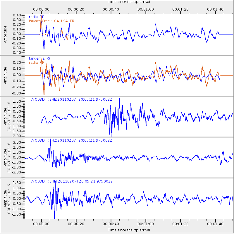
O03D Paynes Creek, CA, USA - Earthquake Result Viewer
*The percent match for this event was below the threshold and hence no stack was calculated.
| Earthquake location: |
Solomon Islands |
| Earthquake latitude/longitude: |
-7.2/155.2 |
| Earthquake time(UTC): |
2011/02/07 (038) 19:53:44 GMT |
| Earthquake Depth: |
429 km |
| Earthquake Magnitude: |
5.9 MB, 6.4 MW, 6.4 MW |
| Earthquake Catalog/Contributor: |
WHDF/NEIC |
|
| Network: |
TA USArray Transportable Network (new EarthScope stations) |
| Station: |
O03D Paynes Creek, CA, USA |
| Lat/Lon: |
40.29 N/121.80 W |
| Elevation: |
968 m |
|
| Distance: |
89.3 deg |
| Az: |
49.399 deg |
| Baz: |
260.074 deg |
| Ray Param: |
$rayparam |
*The percent match for this event was below the threshold and hence was not used in the summary stack. |
|
| Radial Match: |
64.583824 % |
| Radial Bump: |
400 |
| Transverse Match: |
47.49882 % |
| Transverse Bump: |
400 |
| SOD ConfigId: |
350818 |
| Insert Time: |
2011-07-22 07:20:48.833 +0000 |
| GWidth: |
2.5 |
| Max Bumps: |
400 |
| Tol: |
0.001 |
|
Signal To Noise
| Channel | StoN | STA | LTA |
| TA:O03D: :BHZ:20110207T20:05:21.975002Z | 2.9449964 | 6.687053E-7 | 2.2706489E-7 |
| TA:O03D: :BHN:20110207T20:05:21.975002Z | 1.6002448 | 3.303457E-7 | 2.0643448E-7 |
| TA:O03D: :BHE:20110207T20:05:21.975002Z | 1.7358651 | 4.2100734E-7 | 2.425346E-7 |
| Arrivals |
| Ps | |
| PpPs | |
| PsPs/PpSs | |


