You are here: Home > Network List > TA - USArray Transportable Network (new EarthScope stations) Stations List
> Station A04D Lummi Island, WA, USA > Earthquake Result Viewer
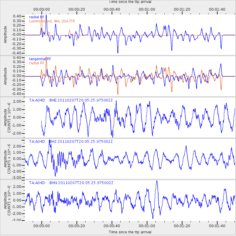
A04D Lummi Island, WA, USA - Earthquake Result Viewer
*The percent match for this event was below the threshold and hence no stack was calculated.
| Earthquake location: |
Solomon Islands |
| Earthquake latitude/longitude: |
-7.2/155.2 |
| Earthquake time(UTC): |
2011/02/07 (038) 19:53:44 GMT |
| Earthquake Depth: |
429 km |
| Earthquake Magnitude: |
5.9 MB, 6.4 MW, 6.4 MW |
| Earthquake Catalog/Contributor: |
WHDF/NEIC |
|
| Network: |
TA USArray Transportable Network (new EarthScope stations) |
| Station: |
A04D Lummi Island, WA, USA |
| Lat/Lon: |
48.72 N/122.71 W |
| Elevation: |
13 m |
|
| Distance: |
90.2 deg |
| Az: |
40.994 deg |
| Baz: |
259.399 deg |
| Ray Param: |
$rayparam |
*The percent match for this event was below the threshold and hence was not used in the summary stack. |
|
| Radial Match: |
51.904358 % |
| Radial Bump: |
400 |
| Transverse Match: |
48.919643 % |
| Transverse Bump: |
400 |
| SOD ConfigId: |
350818 |
| Insert Time: |
2011-07-22 07:21:24.559 +0000 |
| GWidth: |
2.5 |
| Max Bumps: |
400 |
| Tol: |
0.001 |
|
Signal To Noise
| Channel | StoN | STA | LTA |
| TA:A04D: :BHZ:20110207T20:05:25.975002Z | 2.8749104 | 1.313138E-6 | 4.567579E-7 |
| TA:A04D: :BHN:20110207T20:05:25.975002Z | 0.63859415 | 7.2917027E-7 | 1.1418367E-6 |
| TA:A04D: :BHE:20110207T20:05:25.975002Z | 0.47504488 | 4.6992332E-7 | 9.892188E-7 |
| Arrivals |
| Ps | |
| PpPs | |
| PsPs/PpSs | |


