You are here: Home > Network List > TA - USArray Transportable Network (new EarthScope stations) Stations List
> Station X35A Drake, OK, USA > Earthquake Result Viewer
X35A Drake, OK, USA - Earthquake Result Viewer

| Earthquake location: |
Near Coast Of Central Chile |
| Earthquake latitude/longitude: |
-36.5/-73.1 |
| Earthquake time(UTC): |
2011/02/11 (042) 20:05:30 GMT |
| Earthquake Depth: |
28 km |
| Earthquake Magnitude: |
6.0 MB, 6.8 MW, 6.8 MW |
| Earthquake Catalog/Contributor: |
WHDF/NEIC |
|
| Network: |
TA USArray Transportable Network (new EarthScope stations) |
| Station: |
X35A Drake, OK, USA |
| Lat/Lon: |
34.40 N/96.97 W |
| Elevation: |
300 m |
|
| Distance: |
73.9 deg |
| Az: |
339.641 deg |
| Baz: |
160.176 deg |
| Ray Param: |
0.05263538 |
| Estimated Moho Depth: |
11.25 km |
| Estimated Crust Vp/Vs: |
1.89 |
| Assumed Crust Vp: |
6.426 km/s |
| Estimated Crust Vs: |
3.391 km/s |
| Estimated Crust Poisson's Ratio: |
0.31 |
|
| Radial Match: |
81.83555 % |
| Radial Bump: |
400 |
| Transverse Match: |
81.324905 % |
| Transverse Bump: |
400 |
| SOD ConfigId: |
350818 |
| Insert Time: |
2011-07-22 09:39:20.084 +0000 |
| GWidth: |
2.5 |
| Max Bumps: |
400 |
| Tol: |
0.001 |
|
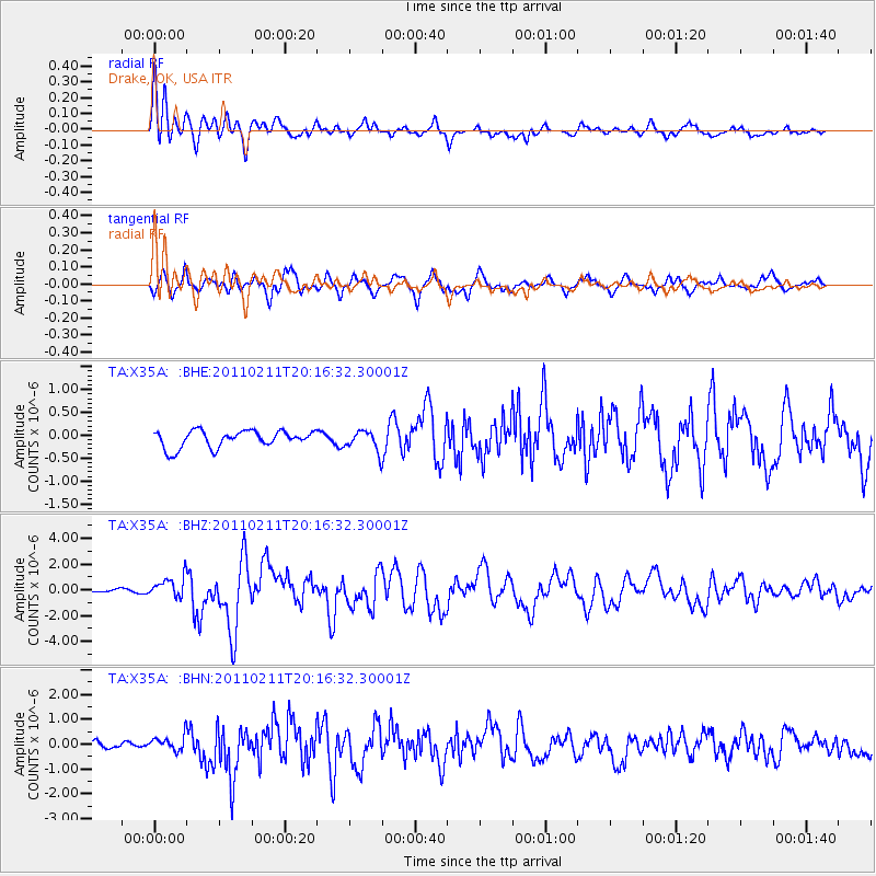
Signal To Noise
| Channel | StoN | STA | LTA |
| TA:X35A: :BHZ:20110211T20:16:32.30001Z | 2.6524081 | 8.1967346E-7 | 3.090299E-7 |
| TA:X35A: :BHN:20110211T20:16:32.30001Z | 1.6802309 | 2.94693E-7 | 1.7538841E-7 |
| TA:X35A: :BHE:20110211T20:16:32.30001Z | 1.2040241 | 2.217595E-7 | 1.8418194E-7 |
| Arrivals |
| Ps | 1.6 SECOND |
| PpPs | 4.9 SECOND |
| PsPs/PpSs | 6.5 SECOND |


