You are here: Home > Network List > TA - USArray Transportable Network (new EarthScope stations) Stations List
> Station L04D Klamath Falls, OR, USA > Earthquake Result Viewer
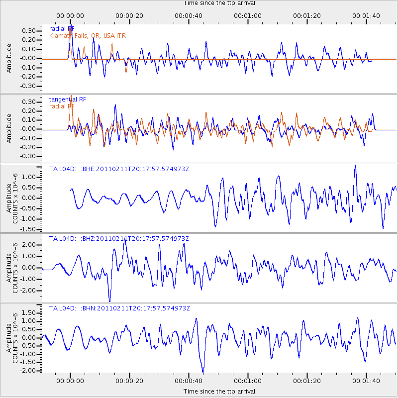
L04D Klamath Falls, OR, USA - Earthquake Result Viewer
*The percent match for this event was below the threshold and hence no stack was calculated.
| Earthquake location: |
Near Coast Of Central Chile |
| Earthquake latitude/longitude: |
-36.5/-73.1 |
| Earthquake time(UTC): |
2011/02/11 (042) 20:05:30 GMT |
| Earthquake Depth: |
28 km |
| Earthquake Magnitude: |
6.0 MB, 6.8 MW, 6.8 MW |
| Earthquake Catalog/Contributor: |
WHDF/NEIC |
|
| Network: |
TA USArray Transportable Network (new EarthScope stations) |
| Station: |
L04D Klamath Falls, OR, USA |
| Lat/Lon: |
42.22 N/122.30 W |
| Elevation: |
1437 m |
|
| Distance: |
90.3 deg |
| Az: |
325.795 deg |
| Baz: |
142.412 deg |
| Ray Param: |
$rayparam |
*The percent match for this event was below the threshold and hence was not used in the summary stack. |
|
| Radial Match: |
60.824207 % |
| Radial Bump: |
400 |
| Transverse Match: |
54.302444 % |
| Transverse Bump: |
400 |
| SOD ConfigId: |
350818 |
| Insert Time: |
2011-07-22 09:56:04.882 +0000 |
| GWidth: |
2.5 |
| Max Bumps: |
400 |
| Tol: |
0.001 |
|
Signal To Noise
| Channel | StoN | STA | LTA |
| TA:L04D: :BHZ:20110211T20:17:57.574973Z | 1.7577671 | 6.344138E-7 | 3.609203E-7 |
| TA:L04D: :BHN:20110211T20:17:57.574973Z | 1.6960225 | 5.268406E-7 | 3.1063303E-7 |
| TA:L04D: :BHE:20110211T20:17:57.574973Z | 1.6185433 | 3.6953313E-7 | 2.2831217E-7 |
| Arrivals |
| Ps | |
| PpPs | |
| PsPs/PpSs | |


