You are here: Home > Network List > TA - USArray Transportable Network (new EarthScope stations) Stations List
> Station D37A Cotton, MN, USA > Earthquake Result Viewer
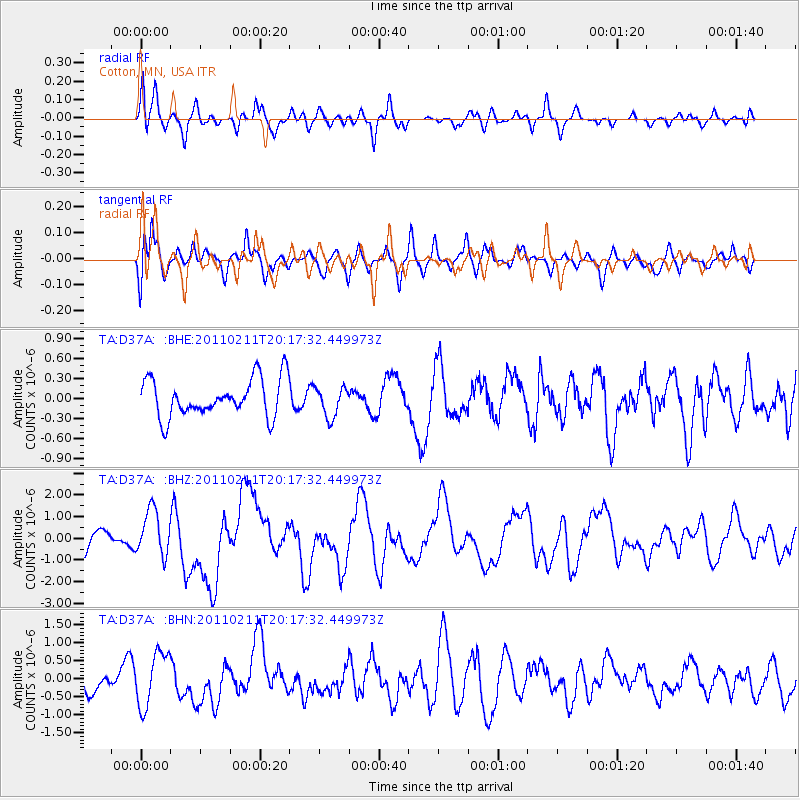
D37A Cotton, MN, USA - Earthquake Result Viewer
*The percent match for this event was below the threshold and hence no stack was calculated.
| Earthquake location: |
Near Coast Of Central Chile |
| Earthquake latitude/longitude: |
-36.5/-73.1 |
| Earthquake time(UTC): |
2011/02/11 (042) 20:05:30 GMT |
| Earthquake Depth: |
28 km |
| Earthquake Magnitude: |
6.0 MB, 6.8 MW, 6.8 MW |
| Earthquake Catalog/Contributor: |
WHDF/NEIC |
|
| Network: |
TA USArray Transportable Network (new EarthScope stations) |
| Station: |
D37A Cotton, MN, USA |
| Lat/Lon: |
47.16 N/92.43 W |
| Elevation: |
413 m |
|
| Distance: |
85.0 deg |
| Az: |
346.914 deg |
| Baz: |
164.489 deg |
| Ray Param: |
$rayparam |
*The percent match for this event was below the threshold and hence was not used in the summary stack. |
|
| Radial Match: |
65.48461 % |
| Radial Bump: |
370 |
| Transverse Match: |
65.042244 % |
| Transverse Bump: |
400 |
| SOD ConfigId: |
350818 |
| Insert Time: |
2011-07-22 10:02:31.592 +0000 |
| GWidth: |
2.5 |
| Max Bumps: |
400 |
| Tol: |
0.001 |
|
Signal To Noise
| Channel | StoN | STA | LTA |
| TA:D37A: :BHZ:20110211T20:17:32.449973Z | 2.398545 | 1.05212E-6 | 4.3864927E-7 |
| TA:D37A: :BHN:20110211T20:17:32.449973Z | 2.062801 | 7.4887043E-7 | 3.6303572E-7 |
| TA:D37A: :BHE:20110211T20:17:32.449973Z | 0.79551214 | 2.249742E-7 | 2.8280422E-7 |
| Arrivals |
| Ps | |
| PpPs | |
| PsPs/PpSs | |


