You are here: Home > Network List > TA - USArray Transportable Network (new EarthScope stations) Stations List
> Station F31A Hecla, SD, USA > Earthquake Result Viewer
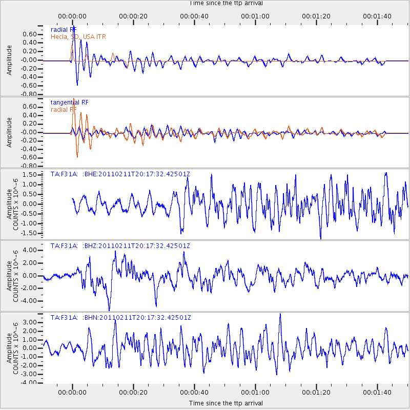
F31A Hecla, SD, USA - Earthquake Result Viewer
*The percent match for this event was below the threshold and hence no stack was calculated.
| Earthquake location: |
Near Coast Of Central Chile |
| Earthquake latitude/longitude: |
-36.5/-73.1 |
| Earthquake time(UTC): |
2011/02/11 (042) 20:05:30 GMT |
| Earthquake Depth: |
28 km |
| Earthquake Magnitude: |
6.0 MB, 6.8 MW, 6.8 MW |
| Earthquake Catalog/Contributor: |
WHDF/NEIC |
|
| Network: |
TA USArray Transportable Network (new EarthScope stations) |
| Station: |
F31A Hecla, SD, USA |
| Lat/Lon: |
45.86 N/98.25 W |
| Elevation: |
412 m |
|
| Distance: |
85.0 deg |
| Az: |
342.671 deg |
| Baz: |
159.906 deg |
| Ray Param: |
$rayparam |
*The percent match for this event was below the threshold and hence was not used in the summary stack. |
|
| Radial Match: |
75.68011 % |
| Radial Bump: |
400 |
| Transverse Match: |
67.298134 % |
| Transverse Bump: |
400 |
| SOD ConfigId: |
350818 |
| Insert Time: |
2011-07-22 10:03:15.266 +0000 |
| GWidth: |
2.5 |
| Max Bumps: |
400 |
| Tol: |
0.001 |
|
Signal To Noise
| Channel | StoN | STA | LTA |
| TA:F31A: :BHZ:20110211T20:17:32.42501Z | 2.8406284 | 9.1593597E-7 | 3.224413E-7 |
| TA:F31A: :BHN:20110211T20:17:32.42501Z | 0.64337903 | 5.3530886E-7 | 8.320272E-7 |
| TA:F31A: :BHE:20110211T20:17:32.42501Z | 1.3085762 | 3.8288528E-7 | 2.9259684E-7 |
| Arrivals |
| Ps | |
| PpPs | |
| PsPs/PpSs | |


