You are here: Home > Network List > IU - Global Seismograph Network (GSN - IRIS/USGS) Stations List
> Station RSSD Black Hills, South Dakota, USA > Earthquake Result Viewer
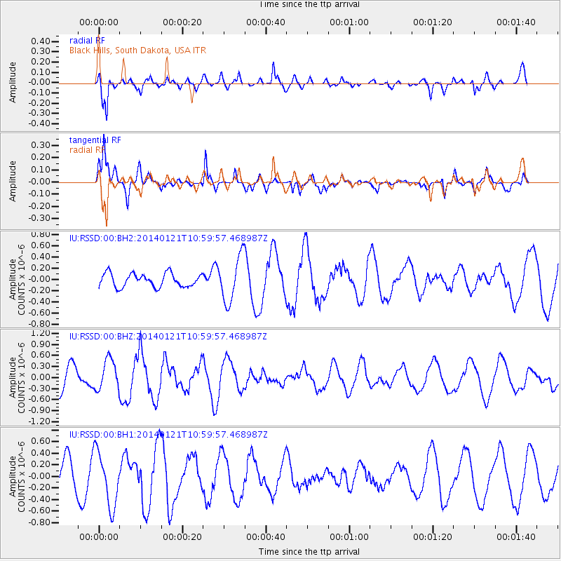
RSSD Black Hills, South Dakota, USA - Earthquake Result Viewer
*The percent match for this event was below the threshold and hence no stack was calculated.
| Earthquake location: |
Kuril Islands |
| Earthquake latitude/longitude: |
49.1/156.3 |
| Earthquake time(UTC): |
2014/01/21 (021) 10:50:00 GMT |
| Earthquake Depth: |
34 km |
| Earthquake Magnitude: |
5.5 MW |
| Earthquake Catalog/Contributor: |
ISC/ISC |
|
| Network: |
IU Global Seismograph Network (GSN - IRIS/USGS) |
| Station: |
RSSD Black Hills, South Dakota, USA |
| Lat/Lon: |
44.12 N/104.04 W |
| Elevation: |
2090 m |
|
| Distance: |
63.7 deg |
| Az: |
52.352 deg |
| Baz: |
313.687 deg |
| Ray Param: |
$rayparam |
*The percent match for this event was below the threshold and hence was not used in the summary stack. |
|
| Radial Match: |
67.46227 % |
| Radial Bump: |
400 |
| Transverse Match: |
73.97849 % |
| Transverse Bump: |
363 |
| SOD ConfigId: |
3390531 |
| Insert Time: |
2019-04-10 01:47:31.336 +0000 |
| GWidth: |
2.5 |
| Max Bumps: |
400 |
| Tol: |
0.001 |
|
Signal To Noise
| Channel | StoN | STA | LTA |
| IU:RSSD:00:BHZ:20140121T10:59:57.468987Z | 0.96030617 | 4.144552E-7 | 4.315865E-7 |
| IU:RSSD:00:BH1:20140121T10:59:57.468987Z | 1.8928918 | 4.622476E-7 | 2.4420183E-7 |
| IU:RSSD:00:BH2:20140121T10:59:57.468987Z | 3.4982998 | 4.1362722E-7 | 1.18236635E-7 |
| Arrivals |
| Ps | |
| PpPs | |
| PsPs/PpSs | |


