You are here: Home > Network List > AZ - ANZA Regional Network Stations List
> Station HWB AZ.HWB > Earthquake Result Viewer
HWB AZ.HWB - Earthquake Result Viewer
*The percent match for this event was below the threshold and hence no stack was calculated.
| Earthquake location: |
South Of Fiji Islands |
| Earthquake latitude/longitude: |
-26.1/-178.4 |
| Earthquake time(UTC): |
2009/08/18 (230) 21:20:47 GMT |
| Earthquake Depth: |
270 km |
| Earthquake Magnitude: |
5.5 MB, 6.3 MW, 6.3 MW |
| Earthquake Catalog/Contributor: |
WHDF/NEIC |
|
| Network: |
AZ ANZA Regional Network |
| Station: |
HWB AZ.HWB |
| Lat/Lon: |
33.03 N/116.96 W |
| Elevation: |
478 m |
|
| Distance: |
82.9 deg |
| Az: |
48.036 deg |
| Baz: |
232.761 deg |
| Ray Param: |
$rayparam |
*The percent match for this event was below the threshold and hence was not used in the summary stack. |
|
| Radial Match: |
42.9078 % |
| Radial Bump: |
400 |
| Transverse Match: |
25.950861 % |
| Transverse Bump: |
400 |
| SOD ConfigId: |
2622 |
| Insert Time: |
2010-02-26 19:27:59.191 +0000 |
| GWidth: |
2.5 |
| Max Bumps: |
400 |
| Tol: |
0.001 |
|
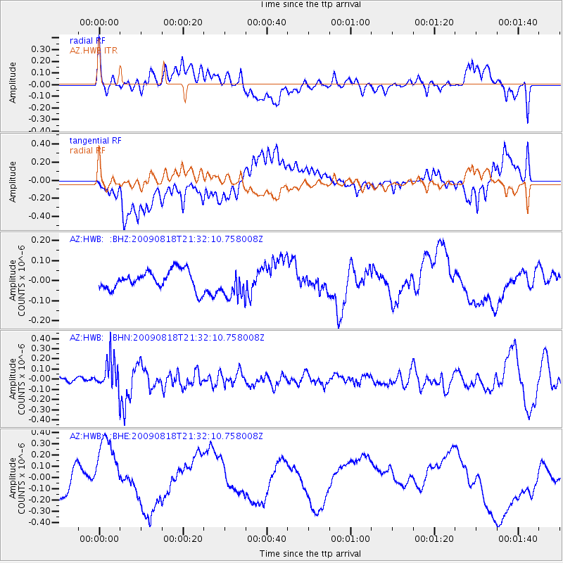
Signal To Noise
| Channel | StoN | STA | LTA |
| AZ:HWB: :BHN:20090818T21:32:10.758008Z | 4.393352 | 1.57052E-7 | 3.5747647E-8 |
| AZ:HWB: :BHE:20090818T21:32:10.758008Z | 2.4912965 | 2.843056E-7 | 1.1411954E-7 |
| AZ:HWB: :BHZ:20090818T21:32:10.758008Z | 1.5793134 | 7.377381E-8 | 4.6712582E-8 |
| Arrivals |
| Ps | |
| PpPs | |
| PsPs/PpSs | |


